METAR-TAF
Airports :
Quatro de Fevereiro Airport
Luanda, Angola
latitude: 08-51S, longitude: 013-14E, elevation: 74 m
Current weather observation
The report was made 37 minutes ago, at 03:00 UTC
Wind 3 kt from variable directions
Temperature 27°C
Pressure 1008 hPa
Visibility: 8000 m
Scattered clouds at a height of 1700 ft
Broken clouds at a height of 2000 ft
Broken clouds at a height of 2000 ft
light drizzle,
METAR: FNLU 260300Z VRB03KT 8000 -DZ SCT017 BKN020 27/// Q1008 NOSIG
Time: 04:37 (03:37 UTC)
Forecast
The report was made 4 hours and 37 minutes ago, at 23:00 UTC
Forecast valid from 26 at 00 UTC to 27 at 06 UTC
Wind 4 kt from the South/Southwest
Visibility: 9000 m
Few clouds at a height of 1500 ft
Scattered clouds at a height of 2000 ft
Broken clouds at a height of 4000 ft
Scattered clouds at a height of 2000 ft
Broken clouds at a height of 4000 ft
Temporary
from 26 at 00 UTC to 26 at 06 UTC
from 26 at 00 UTC to 26 at 06 UTC
Visibility: 3000 m
Broken clouds at a height of 1500 ft
Few clouds at a height of 2000 ft, Cumulonimbus.
Few clouds at a height of 2000 ft, Cumulonimbus.
thunderstorm, light rain,
TAF: FNLU 252300Z 2600/2706 20004KT 9000 FEW015 SCT020 BKN040 TEMPO 2600/2606 3000 -TSRA BKN015 FEW020CB
Weather observations and forecasts of more than 4000 airports (METAR and TAF reports).
The available stations are represented by yellow and red dots on the map.
Hover mouse over dot to see the name of the station.
Then click to see weather observations and forecasts.
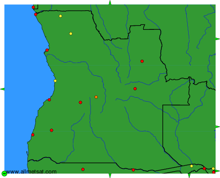
To change the map : click on the green buttons with a black cross to zoom in, on the green button with a dash to zoom out, or on the green arrows for adjacent maps.