METAR-TAF
Airports :
Hong Kong
Almaty
Bahrain
Bangkok
Beijing
Brunei
Chengdu
Chennai
Chita
Chongqing
Dubai
Dushanbe
Guilin
Hagåtña
Hanoi
Harbin
Ho Chi Minh City
Hong Kong
Irkutsk
Islamabad
Kabul
Karachi
Kathmandu
Kolkata
Koror
Kuala Lumpur
Kunming
Kuwait City
Malé
Manila
Mumbai
New Delhi
Novosibirsk
Pyongyang
Seoul-Incheon
Shanghai-Pudong
Singapore-Changi
Taipei
Tashkent
Tehran
Tokyo-Haneda
Ulan Bator
Vientiane
Vladivostok
Xi'an
Yakutsk
Yap
Yekaterinburg
Asia
Afghanistan
Africa
Arctic Ocean
Australia, Oceania
Bahrain
Bangladesh
Bhutan
Cambodia
Central Siberia
China
China, East
Europe
Hong Kong
India
Indian Ocean
Iran
Japan
Japan, Hokkaido
Japan, Honshu
Japan, Kyushu Shikoku
Japan, Ryukyu Islands
Japan, Sapporo
Japan, Tokyo
Kazakhstan
Kyrgyzstan
Laos
Macau
Malaysia
Mariana Islands
Mongolia
Myanmar
Nepal
North Korea
North Pacific
Oman
Pakistan
Philippines
Qatar
Saudi Arabia
Singapore
South Korea
Sri Lanka
Taiwan
Tajikistan
Thailand
Turkmenistan
United Arab Emirates
Uzbekistan
Vietnam
Western Siberia
Yemen
Hong Kong International Airport Hong Kong, China
latitude: 22-19N, longitude: 113-55E, elevation: 9 m
Current weather observation The report was made 28 minutes ago, at 02:00 UTC
Wind 13 kt from the North/Northwest
Temperature 29 °C
Humidity 70 %
Pressure 1008 hPa
Visibility 10 km or more
Few clouds at a height of 2000 ft Scattered clouds at a height of 4500 ft
METAR: VHHH 190200Z 34013KT 9999 FEW020 SCT045 29/23 Q1008 NOSIG
Time: 10:28 (02:28 UTC) Forecast The report was made 28 minutes ago, at 02:00 UTC
Forecast valid from 19 at 03 UTC to 20 at 09 UTC
Wind 10 kt from the North/Northwest
Visibility 10 km or more
Few clouds at a height of 2000 ft Scattered clouds at a height of 3000 ft
Temporary from 19 at 03 UTC to 19 at 09 UTC
Wind 15 kt from the North/Northwest with gusts up to 30 kt
Visibility: 3000 m
Few clouds at a height of 800 ft, Cumulonimbus. Scattered clouds at a height of 2000 ft
rain showers
Becoming from 19 at 09 UTC to 19 at 11 UTC
Wind 20 kt from the Northwest
Temporary from 19 at 09 UTC to 19 at 16 UTC
Wind 25 kt from the West/Northwest with gusts up to 35 kt
Visibility: 1500 m
Few clouds at a height of 600 ft, Cumulonimbus. Scattered clouds at a height of 1500 ft
heavy rain showers
Becoming from 19 at 16 UTC to 19 at 18 UTC
Wind 20 kt from the West
Temporary from 19 at 16 UTC to 19 at 24 UTC
Wind 20 kt from the West/Southwest with gusts up to 35 kt
Visibility: 2000 m
Few clouds at a height of 800 ft, Cumulonimbus. Scattered clouds at a height of 2000 ft
heavy rain showers
Temporary from 20 at 00 UTC to 20 at 09 UTC
Wind 15 kt from the Southwest with gusts up to 30 kt
Visibility: 2500 m
Few clouds at a height of 1000 ft, Cumulonimbus. Scattered clouds at a height of 2000 ft
heavy rain showers
TAF: VHHH 190200Z 1903/2009 34010KT 9999 FEW020 SCT030 TX31/1906Z TX31/2006Z TN27/1922Z TEMPO 1903/1909 34015G30KT 3000 SHRA FEW008CB SCT020 BECMG 1909/1911 32020KT TEMPO 1909/1916 30025G35KT 1500 +SHRA FEW006CB SCT015 BECMG 1916/1918 26020KT TEMPO 1916/1924 24020G35KT 2000 +SHRA FEW008CB SCT020 TEMPO 2000/2009 22015G30KT 2500 +SHRA FEW010CB SCT020
Weather observations and forecasts of more than 4000 airports (METAR and TAF reports).
The available stations are represented by yellow and red dots on the map.
Hover mouse over dot to see the name of the station.
Then click to see weather observations and forecasts.
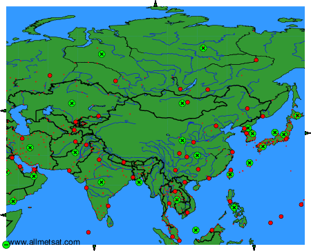
To change the map : click on the green buttons with a black cross to zoom in, on the green button with a dash to zoom out, or on the green arrows for adjacent maps.