METAR-TAF
Airports :
Kotoka International Airport
Accra, Ghana
latitude: 05-36N, longitude: 000-10W, elevation: 68 m
Current weather observation
The report was made 47 minutes ago, at 10:00 UTC
Wind 10 kt from the South/Southwest
Temperature 26°C
Humidity 89%
Pressure 1016 hPa
Visibility 10 km or more
Scattered clouds at a height of 1200 ft
Broken clouds at a height of 1800 ft
Broken clouds at a height of 2700 ft
Broken clouds at a height of 1800 ft
Broken clouds at a height of 2700 ft
METAR: DGAA 081000Z 20010KT 9999 SCT012 BKN018 BKN027 26/24 Q1016 NOSIG
Time: 10:47 (10:47 UTC)
Forecast
The report was made 5 hours and 47 minutes ago, at 05:00 UTC
Forecast valid from 08 at 06 UTC to 09 at 12 UTC
Wind 10 kt from the Southwest
Visibility 10 km or more
Scattered clouds at a height of 1200 ft
Broken clouds at a height of 1700 ft
Broken clouds at a height of 1700 ft
Becoming
between 08 and 0B UTC
between 08 and 0B UTC
TAF: DGAA 080500Z 0806/0912 23010KT 9999 SCT012 BKN017 BECMG 080BBB 080500Z NIL
Weather observations and forecasts of more than 4000 airports (METAR and TAF reports).
The available stations are represented by yellow and red dots on the map.
Hover mouse over dot to see the name of the station.
Then click to see weather observations and forecasts.
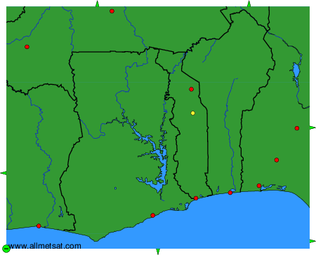
To change the map : click on the green buttons with a black cross to zoom in, on the green button with a dash to zoom out, or on the green arrows for adjacent maps.