METAR-TAF
Airports :
Polyarny
Abakan
Barnaul
Blagoveshchensk
Bratsk
Changchun
Chita
Chitose
Harbin
Irkutsk
Kemerovo
Khabarovsk
Krasnoyarsk
Novosibirsk
Oskemen
Sapporo
Tomsk
Ulan Bator
Ulan-Ude
Ürümqi
Vladivostok
Wakkanai
Yakutsk
Central Siberia
Arctic Ocean
Asia
China
Eastern Siberia
Japan
Japan, Hokkaido
Japan, Sapporo
Kazakhstan
Kyrgyzstan
Mongolia
North Korea
Tajikistan
Turkmenistan
Uzbekistan
Western Siberia
Polyarny Airport Polyarny, Russia
latitude: 66-24-02N, longitude: 112-01-49E, elevation: 509 m
Current weather observation The report was made 7 hours and 35 minutes ago, at 09:00 UTC
Wind 10 kt from the West/Northwest with gusts up to 19 kt
Temperature -4 °C
Humidity 74 %
Pressure 1013 hPa
Visibility 10 km or more
Scattered clouds at a height of 2000 ft, Cumulonimbus. Broken clouds at a height of 10000 ft
light snow showers
METAR: UERP 250900Z 30005G10MPS 9999 -SHSN SCT020CB BKN100 M04/M08 Q1013 R35/820250 NOSIG RMK QFE716
Time: 01:35 (16:35 UTC) Forecast The report was made 11 hours and 35 minutes ago, at 05:00 UTC
Forecast valid from 25 at 06 UTC to 26 at 06 UTC
Wind 12 kt from the West/Northwest with gusts up to 23 kt
Visibility: 8000 m
Scattered clouds at a height of 1700 ft, Cumulonimbus. Broken clouds at a height of 10000 ft
Temporary from 25 at 06 UTC to 25 at 15 UTC
Wind 10 kt from the Northwest with gusts up to 19 kt
Visibility: 4000 m
Broken clouds at a height of 1200 ft, Cumulonimbus. Overcast at a height of 10000 ft
light snow showers, Low drifting snow
Temporary from 25 at 15 UTC to 26 at 03 UTC
Visibility: 2100 m
at a height of 400 ft
light snow showers,
TAF: UERP 250500Z 2506/2606 29006G12MPS 8000 SCT017CB BKN100 TEMPO 2506/2515 32005G10MPS 4000 -SHSN DRSN BKN012CB OVC100 TEMPO 2515/2603 2100 -SHSN VV004
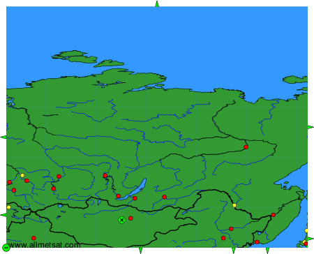
Weather observations and forecasts of more than 4000 airports (METAR and TAF reports).
The available stations are represented by yellow and red dots on the map.
Hover mouse over dot to see the name of the station.
Then click to see weather observations and forecasts.
To change the map : click on the green buttons with a black cross to zoom in, on the green button with a dash to zoom out, or on the green arrows for adjacent maps.