METAR-TAF
Airports :
Kish
Abadan
Abadeh
Abu Musa
Aghajari
Ahvaz
Al-Hasa
Ali Al Salem
Al Udeid
Ardabil
Asaluyeh
Ashgabat
Baghdad
Bahrain
Baku
Balad
Bandar Abbas
Bandar Kangan
Bandar Lengeh
Basra
Birjand
Bojnourd
Bushehr
Dammam
Dhahran
Doha
Doha
Dubai
Dubai
Esfahān
Fasa
Fujairah
Gachsaran
Gonabad
Gorgan
Gwadar
Hafar Al-Batin
Hamedan
Herat
Ilam
Iranshahr
Jask
Jubail
Kalaleh
Karaj
Kashan
Kashmar
Kerman
Kermanshah
Kharg Island
Khorramabad
Kish
Kuwait City
Lamerd
Lankaran
Lar
Lavan Island
Mahshahr
Maragheh
Mary
Mashhad
Masjed Soleyman
Najaf
Nakhchivan
Noshahr
Parsabad
Qaisumah
Qazvin
Qeshm
Ramsar
Ras al-Khaimah
Rasht
Riyadh
Riyadh
Sabzevar
Sanandaj
Sarakhs
Sari
Semnan
Shahrekord
Sharjah
Shiraz
Sirri
Sulaymaniyah
Tabas
Tabriz
Tehran
Tehran
Türkmenabat
Türkmenbaşy
Urmia
Yasuj
Yazd
Yerevan
Yüksekova
Zabol
Zahedan
Zanjan
Iran
Afghanistan
Africa
Armenia
Azerbaijan
Bahrain
Georgia
Iraq
Kazakhstan
Kuwait
Kyrgyzstan
Oman
Pakistan
Qatar
Saudi Arabia
Tajikistan
Turkey
Turkmenistan
United Arab Emirates
Uzbekistan
Kish International Airport Kish, Iran
latitude: 26-31-36N, longitude: 053-58-54E, elevation: 30 m
Current weather observation The report was made 1 hour and 2 minutes ago, at 19:00 UTC
Wind 2 kt from variable directions
Temperature 25 °C
Humidity 69 %
Pressure 1018 hPa
Visibility: 5000 m
haze
METAR: OIBK 171900Z VRB02KT 5000 HZ NSC 25/19 Q1018
Time: 23:32 (20:02 UTC) Forecast The report was made 2 hours and 12 minutes ago, at 17:50 UTC
Forecast valid from 17 at 18 UTC to 18 at 24 UTC
Wind 6 kt from the North/Northwest
Visibility: 4000 m
haze
Temporary from 17 at 21 UTC to 18 at 04 UTC
Wind 6 kt from the North/Northeast
Visibility: 2000 m
Scattered clouds at a height of 2500 ft
Becoming from 18 at 06 UTC to 18 at 08 UTC
Wind 8 kt from the South/Southwest
Visibility: 6000 m
Becoming from 18 at 14 UTC to 18 at 16 UTC
Wind 6 kt from the North/Northwest
Visibility: 4000 m
haze
Temporary from 18 at 21 UTC to 18 at 24 UTC
Wind 6 kt from the North/Northeast
Visibility: 2000 m
Scattered clouds at a height of 2500 ft
TAF: OIBK 171750Z 1718/1824 34006KT 4000 HZ NSC TEMPO 1721/1804 03006KT 2000 HZ/BR SCT025 BECMG 1806/1808 20008KT 6000 BECMG 1814/1816 34006KT 4000 HZ TEMPO 1821/1824 03006KT 2000 BR/HZ SCT025
Weather observations and forecasts of more than 4000 airports (METAR and TAF reports).
The available stations are represented by yellow and red dots on the map.
Hover mouse over dot to see the name of the station.
Then click to see weather observations and forecasts.
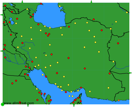
To change the map : click on the green buttons with a black cross to zoom in, on the green button with a dash to zoom out, or on the green arrows for adjacent maps.