METAR-TAF
Airports :
Dublin Airport
Dublin, Ireland
latitude: 53-26N, longitude: 006-15W, elevation: 68 m
Current weather observation
Scattered clouds at a height of 800 ft
Broken clouds at a height of 900 ft
METAR: EIDW 061000Z 13008KT 100V190 9999 FEW006 SCT008 BKN009 14/12 Q0998 BECMG BKN010
Time: 11:20 (10:20 UTC)
Forecast
from 06 at 06 UTC to 06 at 08 UTC
from 06 at 06 UTC to 06 at 13 UTC
from 06 at 09 UTC to 06 at 11 UTC
from 06 at 11 UTC to 06 at 13 UTC
from 06 at 11 UTC to 06 at 13 UTC
from 06 at 13 UTC to 06 at 15 UTC
from 06 at 14 UTC to 06 at 20 UTC
from 06 at 18 UTC to 06 at 20 UTC
from 06 at 21 UTC to 06 at 23 UTC
TAF: EIDW 060500Z 0606/0706 10015G25KT 5000 -RA BKN006 BECMG 0606/0608 12009KT TEMPO 0606/0613 3000 RADZ BR BKN004 BECMG 0609/0611 14004KT BECMG 0611/0613 27005KT PROB30 TEMPO 0611/0613 2000 RADZ BR BECMG 0613/0615 28012KT SCT015 TEMPO 0614/0620 29015G25KT BECMG 0618/0620 24008KT BECMG 0621/0623 21010KT
Weather observations and forecasts of more than 4000 airports (METAR and TAF reports).
The available stations are represented by yellow and red dots on the map.
Hover mouse over dot to see the name of the station.
Then click to see weather observations and forecasts.
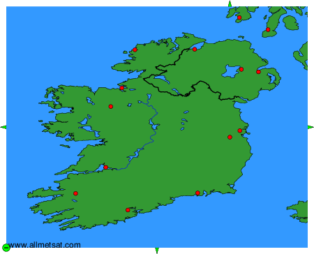
To change the map : click on the green buttons with a black cross to zoom in, on the green button with a dash to zoom out, or on the green arrows for adjacent maps.