The report was made 5 hours and 3 minutes ago, at 23:00 UTC
Forecast valid from 20 at 00 UTC to 21 at 00 UTC
Wind 6 kt from the West/Northwest
Visibility 10 km or more
Few clouds at a height of 4500 ft
Probability 30% :
Temporary from 20 at 02 UTC to 20 at 06 UTC
Visibility: 3000 m
Broken clouds at a height of 1000 ft
Partially covered by fog, mist
Probability 30% :
Temporary from 20 at 06 UTC to 20 at 13 UTC
Scattered clouds at a height of 4000 ft, Towering cumulus.
rain showers
Temporary from 20 at 13 UTC to 20 at 19 UTC
Scattered clouds at a height of 3000 ft, Towering cumulus. Broken clouds at a height of 3300 ft
rain showers
Probability 30% :
Temporary from 20 at 13 UTC to 20 at 16 UTC
Wind 15 kt from the Northwest with gusts up to 25 kt
Visibility: 5000 m
Scattered clouds at a height of 3000 ft, Cumulonimbus. Broken clouds at a height of 3300 ft
thunderstorm, rain
Temporary from 20 at 19 UTC to 20 at 23 UTC
Broken clouds at a height of 1400 ft Overcast at a height of 2500 ft
rain
TAF: LJLJ 192300Z 2000/2100 30006KT 9999 FEW045 PROB30 TEMPO 2002/2006 3000 PRFG BR BKN010 PROB30 TEMPO 2006/2013 SHRA SCT040TCU TEMPO 2013/2019 SHRA SCT030TCU BKN033 PROB30 TEMPO 2013/2016 32015G25KT 5000 TSRA SCT030CB BKN033 TEMPO 2019/2023 RA BKN014 OVC025
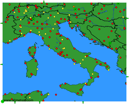
Weather observations and forecasts of more than 4000 airports (METAR and TAF reports).
The available stations are represented by yellow and red dots on the map.
Hover mouse over dot to see the name of the station.
Then click to see weather observations and forecasts.
To change the map : click on the green buttons with a black cross to zoom in, on the green button with a dash to zoom out, or on the green arrows for adjacent maps.