METAR-TAF
Airports :
Kadena Air Base
Kadena, Japan
latitude: 26-21N, longitude: 127-46E, elevation: 45 m
Current weather observation
Overcast at a height of 2000 ft
METAR: RODN 250005Z COR 08007KT 2SM -RA BR BKN015 OVC020 22/20 A2985 RMK AO2A SLP114 PWINO FZRANO $ COR 0016
Time: 10:08 (01:08 UTC)
Forecast
Broken clouds at a height of 2000 ft
from 25 at 00 UTC to 25 at 01 UTC
from 25 at 04 UTC to 25 at 08 UTC
from 25 at 12 UTC to 25 at 13 UTC
Broken clouds at a height of 2000 ft
from 25 at 19 UTC to 25 at 20 UTC
Broken clouds at a height of 1200 ft
from 25 at 21 UTC to 26 at 01 UTC
TAF: RODN 250000Z 2500/2606 06009KT 9999 SCT015 BKN020 QNH2976INS TEMPO 2500/2501 4800 -SHRA BR BKN015 TEMPO 2504/2508 8000 -SHRA BECMG 2512/2513 09009KT 9999 VCSH BKN015 BKN020 QNH2974INS BECMG 2519/2520 12009KT 8000 -SHRA SCT008 BKN012 QNH2969INS TEMPO 2521/2601 12012G18KT 4800 -TSRA BKN008CB TX27/2505Z TN21/2521Z
Weather observations and forecasts of more than 4000 airports (METAR and TAF reports).
The available stations are represented by yellow and red dots on the map.
Hover mouse over dot to see the name of the station.
Then click to see weather observations and forecasts.
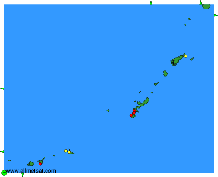
To change the map : click on the green buttons with a black cross to zoom in, on the green button with a dash to zoom out, or on the green arrows for adjacent maps.