METAR: EGLL 081850Z AUTO 21009KT 9999 BKN023 13/11 Q1010 TEMPO 5000 BKN012
Time: 19:10 (19:10 UTC)
Forecast
The report was made 2 hours and 17 minutes ago, at 16:53 UTC
Forecast valid from 08 at 18 UTC to 09 at 24 UTC
Wind 10 kt from the South/Southwest
Visibility 10 km or more
Scattered clouds at a height of 1200 ft Broken clouds at a height of 2000 ft
Temporary from 08 at 18 UTC to 09 at 09 UTC
Visibility: 6000 m
Broken clouds at a height of 900 ft
rain, light rain, drizzle
Probability 40% :
Temporary from 09 at 00 UTC to 09 at 07 UTC
Visibility: 3000 m
heavy rain, rain, drizzle
Probability 30% :
Temporary from 09 at 00 UTC to 09 at 03 UTC
Wind 16 kt from the South with gusts up to 26 kt
Becoming from 09 at 03 UTC to 09 at 06 UTC
Wind 18 kt from the South with gusts up to 30 kt
Temporary from 09 at 09 UTC to 09 at 17 UTC
Visibility: 6000 m
Broken clouds at a height of 1200 ft
light rain, drizzle, rain
Probability 40% :
Temporary from 09 at 12 UTC to 09 at 17 UTC
Visibility: 3000 m
Broken clouds at a height of 900 ft
heavy rain
Becoming from 09 at 18 UTC to 09 at 21 UTC
Wind 12 kt from the South/Southwest
TAF: EGLL 081653Z 0818/0924 21010KT 9999 SCT012 BKN020 TEMPO 0818/0909 6000 RA -RADZ BKN009 PROB40 TEMPO 0900/0907 3000 +RA RADZ PROB30 TEMPO 0900/0903 18016G26KT BECMG 0903/0906 19018G30KT TEMPO 0909/0917 6000 -RADZ RA BKN012 PROB40 TEMPO 0912/0917 3000 +RA BKN009 BECMG 0918/0921 21012KT
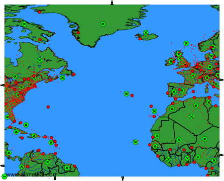
Weather observations and forecasts of more than 4000 airports (METAR and TAF reports).
The available stations are represented by yellow and red dots on the map.
Hover mouse over dot to see the name of the station.
Then click to see weather observations and forecasts.
To change the map : click on the green buttons with a black cross to zoom in, on the green button with a dash to zoom out, or on the green arrows for adjacent maps.