METAR-TAF
Airports :
Kota Kinabalu International Airport
Kota Kinabalu, Malaysia
latitude: 05-56N, longitude: 116-03E, elevation: 3 m
Current weather observation
The report was made 38 minutes ago, at 07:00 UTC
Wind 8 kt from the East/Southeast, varying between East and Southeast
Temperature 29°C
Humidity 79%
Pressure 1005 hPa
Visibility 10 km or more
Few clouds at a height of 1300 ft
Few clouds at a height of 1600 ft, Cumulonimbus.
Few clouds at a height of 1600 ft, Cumulonimbus.
thunderstorm,
METAR: WBKK 190700Z 11008KT 080V140 9999 TS FEW013 FEW016CB 29/25 Q1005 NOSIG
Time: 15:38 (07:38 UTC)
Forecast
The report was made 2 hours and 38 minutes ago, at 05:00 UTC
Forecast valid from 19 at 06 UTC to 20 at 06 UTC
Wind 4 kt from the West/Northwest
Visibility 10 km or more
Few clouds at a height of 1400 ft
Probability 30% :
Temporary
from 19 at 07 UTC to 19 at 11 UTC
from 19 at 07 UTC to 19 at 11 UTC
Visibility: 5000 m
Few clouds at a height of 1000 ft
Few clouds at a height of 1600 ft, Cumulonimbus.
Few clouds at a height of 1600 ft, Cumulonimbus.
thunderstorm, rain
Becoming
from 19 at 11 UTC to 19 at 13 UTC
from 19 at 11 UTC to 19 at 13 UTC
Wind 4 kt from the Southeast
TAF: WBKK 190500Z 1906/2006 30004KT 9999 FEW014 PROB30 TEMPO 1907/1911 5000 TSRA FEW010 FEW016CB BECMG 1911/1913 13004KT
Weather observations and forecasts of more than 4000 airports (METAR and TAF reports).
The available stations are represented by yellow and red dots on the map.
Hover mouse over dot to see the name of the station.
Then click to see weather observations and forecasts.
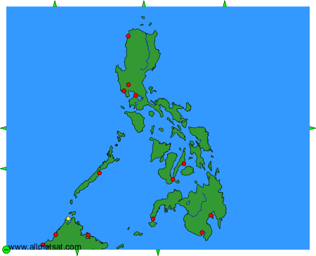
To change the map : click on the green buttons with a black cross to zoom in, on the green button with a dash to zoom out, or on the green arrows for adjacent maps.