METAR-TAF
Airports :
Henry E. Rohlsen Airport
Saint Croix, United States Virgin Islands
latitude: 17-42N, longitude: 064-48W, elevation: 20 m
Current weather observation
The report was made 7 minutes ago, at 07:53 UTC
Wind 10 kt from the East/Southeast
Temperature 27°C
Humidity 79%
Pressure 1015 hPa
Visibility: 16.1 km
Few clouds at a height of 2200 ft
Few clouds at a height of 3000 ft
Few clouds at a height of 3000 ft
METAR: TISX 230753Z AUTO 11010KT 10SM FEW022 FEW030 27/23 A2997 RMK AO2 SLP149 T02720228 PNO $
Time: 04:00 (08:00 UTC)
Forecast
The report was made 2 hours and 23 minutes ago, at 05:37 UTC
Forecast valid from 23 at 06 UTC to 24 at 06 UTC
Wind 8 kt from the East
Visibility: 10 km
Few clouds at a height of 2500 ft
Scattered clouds at a height of 5000 ft
Scattered clouds at a height of 5000 ft
showers in vicinity
From 23 at 1200 UTC
Wind 14 kt from the East/Southeast
Visibility: 9.7 km
Scattered clouds at a height of 2200 ft
haze
From 23 at 2200 UTC
Wind 6 kt from the East
Visibility: 9.7 km
Few clouds at a height of 2200 ft
haze
TAF: TISX 230537Z 2306/2406 10008KT P6SM VCSH FEW025 SCT050 FM231200 12014KT 6SM HZ SCT022 FM232200 08006KT 6SM HZ FEW022
Weather observations and forecasts of more than 4000 airports (METAR and TAF reports).
The available stations are represented by yellow and red dots on the map.
Hover mouse over dot to see the name of the station.
Then click to see weather observations and forecasts.
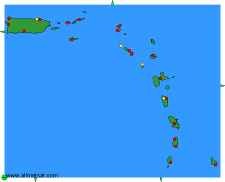
To change the map : click on the green buttons with a black cross to zoom in, on the green button with a dash to zoom out, or on the green arrows for adjacent maps.