METAR-TAF
Airports :
Belfast International Airport
Belfast, Northern Ireland
latitude: 54-39N, longitude: 006-13W, elevation: 81 m
Current weather observation
The report was made 27 minutes ago, at 21:20 UTC
Wind 6 kt from the North
Temperature 16°C
Humidity 88%
Pressure 1019 hPa
Visibility 10 km or more
Scattered clouds at a height of 2500 ft
Broken clouds at a height of 4200 ft
Broken clouds at a height of 4900 ft
Broken clouds at a height of 4200 ft
Broken clouds at a height of 4900 ft
METAR: EGAA 232120Z AUTO 35006KT 9999 SCT025 BKN042 BKN049 16/14 Q1019
Time: 22:47 (21:47 UTC)
Forecast
The report was made 4 hours and 55 minutes ago, at 16:52 UTC
Forecast valid from 23 at 18 UTC to 24 at 18 UTC
Wind 7 kt from the Northwest
Visibility 10 km or more
Scattered clouds at a height of 4000 ft
Becoming
from 23 at 21 UTC to 23 at 24 UTC
from 23 at 21 UTC to 23 at 24 UTC
Broken clouds at a height of 1400 ft
Temporary
from 24 at 02 UTC to 24 at 09 UTC
from 24 at 02 UTC to 24 at 09 UTC
Visibility: 6000 m
Broken clouds at a height of 700 ft
Becoming
from 24 at 09 UTC to 24 at 12 UTC
from 24 at 09 UTC to 24 at 12 UTC
Scattered clouds at a height of 1800 ft
TAF: EGAA 231652Z 2318/2418 31007KT 9999 SCT040 BECMG 2321/2324 BKN014 TEMPO 2402/2409 6000 BKN007 BECMG 2409/2412 SCT018
Weather observations and forecasts of more than 4000 airports (METAR and TAF reports).
The available stations are represented by yellow and red dots on the map.
Hover mouse over dot to see the name of the station.
Then click to see weather observations and forecasts.
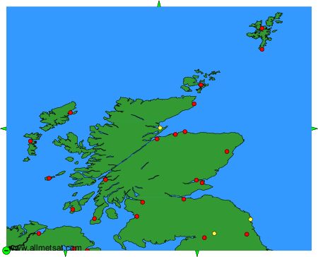
To change the map : click on the green buttons with a black cross to zoom in, on the green button with a dash to zoom out, or on the green arrows for adjacent maps.