METAR-TAF
Airports :
Newcastle Airport
Newcastle upon Tyne, England
latitude: 55-02N, longitude: 001-42W, elevation: 81 m
Current weather observation
METAR: EGNT 151720Z 12008KT 080V140 9999 SCT031 13/07 Q1014
Time: 18:54 (17:54 UTC)
Forecast
from 15 at 18 UTC to 16 at 02 UTC
from 15 at 20 UTC to 16 at 02 UTC
from 15 at 23 UTC to 16 at 02 UTC
from 16 at 02 UTC to 16 at 09 UTC
from 16 at 06 UTC to 16 at 09 UTC
from 16 at 09 UTC to 16 at 16 UTC
from 16 at 10 UTC to 16 at 13 UTC
from 16 at 12 UTC to 16 at 16 UTC
from 16 at 15 UTC to 16 at 18 UTC
TAF: EGNT 151654Z 1518/1618 10010KT 9999 SCT025 TEMPO 1518/1602 8000 -RA PROB40 TEMPO 1520/1602 4000 RA BECMG 1523/1602 BKN008 PROB30 TEMPO 1602/1609 8000 -RADZ BKN004 BECMG 1606/1609 16005KT TEMPO 1609/1616 8000 -RA BECMG 1610/1613 SCT025 PROB30 TEMPO 1612/1616 4500 SHRA BECMG 1615/1618 22010KT
Weather observations and forecasts of more than 4000 airports (METAR and TAF reports).
The available stations are represented by yellow and red dots on the map.
Hover mouse over dot to see the name of the station.
Then click to see weather observations and forecasts.
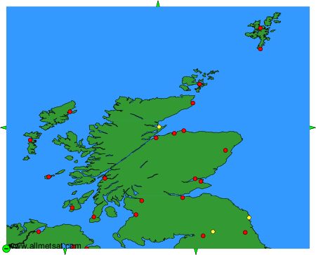
To change the map : click on the green buttons with a black cross to zoom in, on the green button with a dash to zoom out, or on the green arrows for adjacent maps.