METAR-TAF
Airports :
Aberdeen
Aberdeen
Belfast
Belfast City
Benbecula
Boulmer
Campbeltown
Carlisle
Derry
Dundee
Edinburgh
Glasgow
Glasgow-Prestwick
Inverness
Islay
Kinloss
Kirkwall
Leuchars
Lossiemouth
Newcastle upon Tyne
Oban
Scatsta
Spadeadam
Stornoway
Sumburgh
Tain
Tiree
Wick
Scotland
England
Faroe Islands
Ireland
North Atlantic
North Sea
Scandinavia, Southwest
Shetland
United Kingdom
Wales
Aberdeen Airport Aberdeen, Scotland
latitude: 57-12N, longitude: 002-13W, elevation: 65 m
Current weather observation The report was made 26 minutes ago, at 06:50 UTC
Wind 3 kt from the East , varying between Northeast and South/Southeast
Temperature 13 °C
Humidity 88 %
Pressure 1029 hPa
Visibility 10 km or more
Overcast at a height of 900 ft
METAR: EGPD 150650Z AUTO 10003KT 040V160 9999 OVC009 13/11 Q1029
Time: 08:16 (07:16 UTC) Forecast The report was made 2 hours and 22 minutes ago, at 04:54 UTC
Forecast valid from 15 at 06 UTC to 16 at 06 UTC
Wind 3 kt from variable directions
Visibility 10 km or more
Broken clouds at a height of 1000 ft
Temporary
Visibility: 8000 m
Broken clouds at a height of 700 ft
Probability 30% :
Temporary
Visibility: 5000 m
Broken clouds at a height of 400 ft
mist
Becoming
Wind 10 kt from the East/Southeast
Scattered clouds at a height of 1600 ft
Becoming
Wind 3 kt from variable directions
Broken clouds at a height of 800 ft
Temporary
Visibility: 6000 m
Broken clouds at a height of 500 ft
Probability 40%
Visibility: 2000 m
Broken clouds at a height of 200 ft
mist
TAF: EGPD 150454Z 1506/1606 VRB03KT 9999 BKN010 TEMPO 1506/1508 8000 BKN007 PROB30 TEMPO 1506/1507 5000 BR BKN004 BECMG 1508/1511 11010KT SCT016 BECMG 1518/1521 VRB03KT BKN008 TEMPO 1519/1606 6000 BKN005 PROB40 1603/1606 2000 BR BKN002
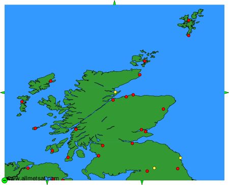
Weather observations and forecasts of more than 4000 airports (METAR and TAF reports).
The available stations are represented by yellow and red dots on the map.
Hover mouse over dot to see the name of the station.
Then click to see weather observations and forecasts.
To change the map : click on the green buttons with a black cross to zoom in, on the green button with a dash to zoom out, or on the green arrows for adjacent maps.