METAR-TAF
Airports :
Glasgow Airport
Glasgow, Scotland
latitude: 55-52N, longitude: 004-26W, elevation: 8 m
Current weather observation
The report was made 20 minutes ago, at 04:50 UTC
Wind 5 kt from the Northeast
Temperature 13°C
Humidity 94%
Pressure 1020 hPa
Visibility: 5000 m
Broken clouds at a height of 900 ft
haze
METAR: EGPF 170450Z AUTO 05005KT 5000 HZ BKN009 13/12 Q1020
Time: 06:10 (05:10 UTC)
Forecast
The report was made 6 hours and 17 minutes ago, at 22:53 UTC
Forecast valid from 17 at 00 UTC to 17 at 24 UTC
Wind 8 kt from the Northeast
Visibility 10 km or more
no clouds below 1500 m and no cumulonimbus
Temporary
from 17 at 00 UTC to 17 at 09 UTC
from 17 at 00 UTC to 17 at 09 UTC
Broken clouds at a height of 1400 ft
Probability 30% :
Temporary
from 17 at 00 UTC to 17 at 06 UTC
from 17 at 00 UTC to 17 at 06 UTC
Visibility: 4500 m
Broken clouds at a height of 800 ft
mist
TAF: EGPF 162253Z 1700/1724 05008KT CAVOK TEMPO 1700/1709 BKN014 PROB30 TEMPO 1700/1706 4500 BR BKN008
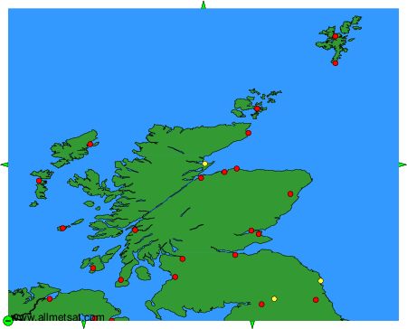
Weather observations and forecasts of more than 4000 airports (METAR and TAF reports).
The available stations are represented by yellow and red dots on the map.
Hover mouse over dot to see the name of the station.
Then click to see weather observations and forecasts.
To change the map : click on the green buttons with a black cross to zoom in, on the green button with a dash to zoom out, or on the green arrows for adjacent maps.