METAR-TAF
Airports :
Brasília
Antofagasta
Asunción
Belém
Bogotá
Brasília
Caracas
Cayenne
Córdoba
Curaçao
Easter Island
El Salvador
Florianópolis
Fort-de-France
Foz do Iguaçu
Guatemala City
La Paz
Lima
Mar del Plata
Mendoza
Natal
Porto Alegre
Port of Spain
Punta Arenas
Quito
Recife
Santiago
São Paulo
Stanley
Tegucigalpa
Ushuaia
South America
Africa
Antarctica
Argentina
Bolivia
Brazil
Brazil, São Paulo, Rio de Janeiro
Chile
Colombia
Costa Rica
Ecuador
Galápagos
Guyana, Suriname, French Guiana
Nicaragua
North America
North Atlantic
Panama
Paraguay
Peru
South Atlantic
South Pacific
Trinidad and Tobago
Uruguay
Venezuela
Brasília International Airport Brasília, Brazilian Federal District, Brazil
latitude: 15-52S, longitude: 047-56W, elevation: 1061 m
Current weather observation The report was made 53 minutes ago, at 03:00 UTC
Wind 2 kt from variable directions
Temperature 23 °C
Humidity 36 %
Pressure 1019 hPa
Visibility 10 km or more
no clouds below 1500 m and no cumulonimbus
METAR: SBBR 130300Z VRB02KT CAVOK 23/07 Q1019
Time: 00:53 (03:53 UTC) Forecast The report was made 8 hours and 53 minutes ago, at 19:00 UTC
Forecast valid from 13 at 00 UTC to 13 at 24 UTC
Wind 5 kt from the Southeast
Visibility 10 km or more
no clouds below 1500 m and no cumulonimbus
Becoming
Wind 2 kt from variable directions
Temporary
Wind 2 kt from the West
Becoming
Wind 8 kt from the East
Probability 30%
Wind 5 kt from variable directions
Becoming
Wind 5 kt from the South
TAF: SBBR 121900Z 1300/1324 14005KT CAVOK TN17/1309Z TX33/1318Z BECMG 1301/1303 VRB02KT TEMPO 1303/1310 28002KT BECMG 1310/1312 10008KT PROB30 1316/1319 VRB05KT BECMG 1319/1321 17005KT RMK PGF
Weather observations and forecasts of more than 4000 airports (METAR and TAF reports).
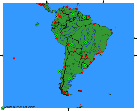
The available stations are represented by yellow and red dots on the map.
Hover mouse over dot to see the name of the station.
Then click to see weather observations and forecasts.
To change the map : click on the green buttons with a black cross to zoom in, on the green button with a dash to zoom out, or on the green arrows for adjacent maps.
