METAR-TAF
Airports :
Josefa Camejo International Airport
Paraguaná, Venezuela
latitude: 11-47N, longitude: 070-09W, elevation: 23 m
Current weather observation
The report was made 1 hour and 14 minutes ago, at 00:00 UTC
Wind 15 kt from the East
Temperature
Pressure 1014 hPa
Visibility 10 km or more
Overcast at a height of 5000 ft
METAR: SVJC 090000Z 09015KT 9999 OVC050 ///// Q1014
Time: 21:14 (01:14 UTC)
Forecast
The report was made 3 hours and 14 minutes ago, at 22:00 UTC
Forecast valid from 09 at 00 UTC to 10 at 00 UTC
Wind 3 kt from the East/Northeast
Visibility: 9000 m
Few clouds at a height of 1300 ft
Scattered clouds at a height of 8000 ft
Scattered clouds at a height of 8000 ft
drizzle
Becoming
from 09 at 01 UTC to 09 at 04 UTC
from 09 at 01 UTC to 09 at 04 UTC
Broken clouds at a height of 1300 ft
From 09 at 0800 UTC
Wind 8 kt from the Northeast
Visibility 10 km or more
Scattered clouds at a height of 1300 ft
TAF: SVJC 082200Z 0900/1000 07003KT 9000 DZ FEW013 SCT080 TX34/19Z TN26/09Z BECMG 0901/0904 BKN013 FM090800 05008KT 9999 SCT013
Weather observations and forecasts of more than 4000 airports (METAR and TAF reports).
The available stations are represented by yellow and red dots on the map.
Hover mouse over dot to see the name of the station.
Then click to see weather observations and forecasts.
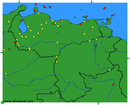
To change the map : click on the green buttons with a black cross to zoom in, on the green button with a dash to zoom out, or on the green arrows for adjacent maps.