METAR-TAF
Airports :
Abakan International Airport
Abakan, Russia
latitude: 53-45N, longitude: 091-24E, elevation: 245 m
Current weather observation
The report was made 31 minutes ago, at 02:00 UTC
Wind 2 kt from variable directions
Temperature 20°C
Humidity 88%
Pressure 1011 hPa
Visibility 10 km or more
no clouds below 1500 m and no cumulonimbus
METAR: UNAA 270200Z VRB01MPS CAVOK 20/18 Q1011 R02/120063 NOSIG RMK QFE736
Time: 09:31 (02:31 UTC)
Forecast
The report was made 32 minutes ago, at 01:59 UTC
Forecast valid from 27 at 03 UTC to 28 at 03 UTC
Wind 6 kt from the North/Northwest with gusts up to 16 kt
Visibility: 8000 m
Scattered clouds at a height of 3000 ft
Temporary
from 27 at 06 UTC to 27 at 15 UTC
from 27 at 06 UTC to 27 at 15 UTC
Wind 16 kt from the North/Northeast with gusts up to 25 kt
Broken clouds at a height of 1600 ft, Cumulonimbus.
thunderstorm, light rain
TAF: UNAA 270159Z 2703/2803 34003G08MPS 8000 SCT030 TEMPO 2706/2715 03008G13MPS -TSRA BKN016CB
Weather observations and forecasts of more than 4000 airports (METAR and TAF reports).
The available stations are represented by yellow and red dots on the map.
Hover mouse over dot to see the name of the station.
Then click to see weather observations and forecasts.
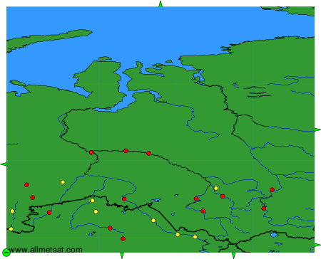
To change the map : click on the green buttons with a black cross to zoom in, on the green button with a dash to zoom out, or on the green arrows for adjacent maps.