Airports
Airports :
Esquimalt Harbour
Abbotsford
Agassiz
Arlington
Ballenas Island
Bella Bella
Bella Coola
Bellingham
Blue River
Burlington / Mount Vernon
Burns Lake
Campbell River
Castlegar
Cathedral Point
Chetwynd
Clinton
Comox
Creston
Dawson Creek
Dease Lake
Eastsound
Edson
Entrance Island
Esquimalt Harbour
Estevan Point
Fort Nelson
Fort St. John
Friday Harbor
Golden
Grande Prairie
Grey Islet
Herbert Island
High Level
Holland Rock
Hope
Ingenika Point
Jasper
Kamloops
Kelowna
Kelp Reefs
Lucy Island
Lytton
Mackenzie
Malahat
Nakusp
Nanaimo
Nelson
Oak Harbor
Omak
Osoyoos
Peace River
Penticton
Pitt Meadows
Port Angeles
Port Angeles
Port Hardy
Port Townsend
Powell River
Prince George
Prince Rupert
Princeton
Princeton
Quesnel
Race Rocks
Revelstoke
Salmon Arm
Sand Heads CS
Sandpoint
Saturna Island
Sheringham
Sisters Islands
Smithers
Solander Islands
Spirit River
Squamish
Stewart
Summerland
Terrace
Tofino
University of Victoria
Vancouver
Vernon
Victoria
Victoria
Victoria Harbour
West Vancouver
Whistler
White Rock
Williams Lake
Yoho National Park
British Columbia
Alaska, British Columbia
Alberta
Idaho
Montana, West
North America
Northwest Territories
Washington
Yukon
Esquimalt Harbour, British Columbia, Canada latitude: 48-26N, longitude: 123-26W, elevation: 3 m
Please enable JavaScript to view this page properly.
Interactive airport maps.
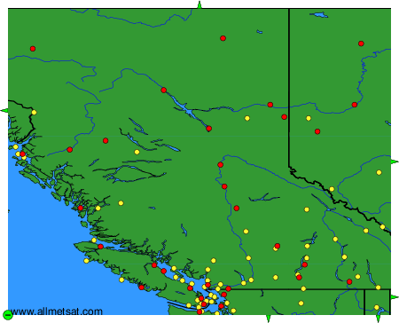
The available airports are represented by yellow and red dots on the map.
Hover mouse over to see the name of the airport.
Then click to see the images.
To change the map : click on the green buttons with a black cross to zoom in, on the green button with a dash to zoom out, or on the green arrows for adjacent maps.
