Airports
Airports :
Titusville
Apalachicola
Bartow
Boca Raton
Brooksville
Cape Canaveral
Clearwater
Cocoa Beach
Crestview
Cross City
Crystal River
Daytona Beach
DeLand
Destin
Duke Field
Fernandina Beach
Fort Lauderdale Executive
Fort Lauderdale-Hollywood
Fort Myers
Fort Myers Page
Fort Pierce
Gainesville
Hollywood
Homestead
Jacksonville-Cecil
Jacksonville-Craig
Jacksonville Intl.
Jacksonville-NAS
Kennedy Space Center
Key West
Kissimmee
Lake City
Lakeland
Leesburg
MacDill AFB
Marathon
Marianna
Mary Esther
Mayport
Melbourne
Miami
Miami Executive
Miami Opa Locka
Milton
Milton
Naples
NAS Key West
New Smyrna Beach
Ocala
Okeechobee
Orlando
Orlando-Executive
Orlando-Sanford
Ormond Beach
Panama City
Pensacola
Pensacola NAS
Perry
Plant City
Pompano Beach
Punta Gorda
Sarasota / Bradenton
Sebring
St. Augustine
St. Petersburg
St. Petersburg-Clearwater
Stuart
Tallahassee
Tampa
Tampa Intl.
The Villages
Titusville
Tyndall AFB
Valdosta
Valparaiso
Venice
Vero Beach
West Palm Beach
Winter Haven
Florida
Alabama
Cuba
Georgia
Jamaica
Louisiana
Mexico
Mississippi
North America
The Bahamas
Space Coast Regional Airport Titusville, Florida, United States
latitude: 28-31N, longitude: 080-48W, elevation: 36 ft
Please enable JavaScript to view this page properly.
Interactive airport maps.
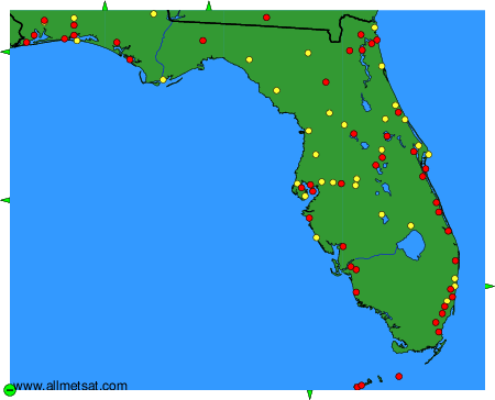
The available airports are represented by yellow and red dots on the map.
Hover mouse over to see the name of the airport.
Then click to see the images.
To change the map : click on the green buttons with a black cross to zoom in, on the green button with a dash to zoom out, or on the green arrows for adjacent maps.
