Climate normals
Climate :
Sachs Harbour
Alert
Anchorage
Arkhangelsk
Barrow
Bear Island
Cape Chelyuskin
Chokurdakh
Danmarkshavn
Dikson Island
Eureka
Fairbanks
Franz Josef Land
Great Lyakhovsky Island
Helsinki
Iqaluit
Jan Mayen
Kangerlussuaq
Khatanga
Kotelny Island
Longyearbyen
Malye Karmakuly
Medvyezhi Islands
Murmansk
Nord
Ny-Ålesund
Oslo
Prince Patrick Island
Resolute
Reykjavík
Sachs Harbour
Thule
Tromsø
Uyedineniya Island
Vize Island
Wrangel Island
Yakutsk
Yellowknife
Arctic Ocean
Alaska
Alaska, Anchorage
Alaska, Anchorage Fairbanks
Asia
Bering Sea
Central Siberia
Eastern Siberia
Europe
Faroe Islands
Finland
Greenland
Iceland
North America
North Atlantic
North Pacific
North Sea
Northwest Territories
Norway
Nunavut
Nunavut, Baffin Island, Ellesmere
Scandinavia, Southwest
Shetland
Sweden
Western Siberia
Yukon
Climate : Sachs Harbour, Northwest Territories, Canada latitude: 72-00N, longitude: 125-16W, elevation: 88 m
Monthly average of the minimum and maximum daily temperatures.°C/°F
Precipitation is any kind of water that falls from the sky as part of the weather. This includes drizzle, rain, hail, sleet, or snow.mm/inch
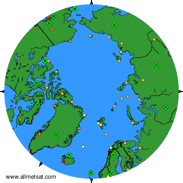
Climatic data of more than 3000 weather stations.
The available stations are represented by yellow and red dots on the map.
Hover mouse over dot to see the name of the station.
Then click to see the data.
To change the map : click on the green buttons with a black cross to zoom in, on the green button with a dash to zoom out, or on the green arrows for adjacent maps.