Climate normals
Climate :
Bhamo
Aparri
Basco
Beijing
Bhamo
Chengdu
Chiang Mai
Chiang Rai
Dibrugarh
Dulan
Ganzhou
Guangzhou
Haikou
Hong Kong
Huaihua
Iriomote
Ishigaki
Jiuquan
Kathar
Kengtung
Kunming
Lampang
Lanzhou
Lashio
Luang Prabang
Mae Hong Son
Mae Sariang
Mandalay
Meiktila
Monywa
Myitkyina
Nan
Nanchang
Nanning
Phrae
Pingbian
Putao
Pyay
Qamdo
Qingdao
Shanghai-Hongqiao
Shantou
Shenyang
Singkaling Hkamti
Sinuiju
Taiyuan
Taoyuan
Taunggyi
Taungoo
Tengchong
Xi'an
Xichang
Yichang
Yinchuan
Yonaguni
Zhengzhou
China, East
Asia
Bangladesh
Bhutan
Cambodia
Central Siberia
China
Hong Kong
India, Northeast
Indonesia
Japan, Kyushu Shikoku
Japan, Ryukyu Islands
Laos
Macau
Mongolia
Myanmar
Nepal
North Korea
Philippines
South Korea
Taiwan
Thailand
Vietnam
Climate : Bhamo, Myanmar latitude: 24-16N, longitude: 097-12E, elevation: 111 m
Monthly average of the minimum and maximum daily temperatures.°C/°F
Precipitation is any kind of water that falls from the sky as part of the weather. This includes drizzle, rain, hail, sleet, or snow.mm/inch
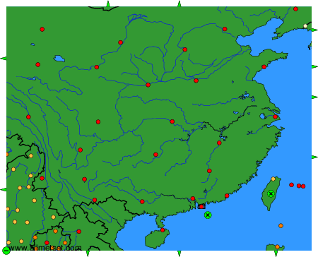
Climatic data of more than 3000 weather stations.
The available stations are represented by yellow and red dots on the map.
Hover mouse over dot to see the name of the station.
Then click to see the data.
To change the map : click on the green buttons with a black cross to zoom in, on the green button with a dash to zoom out, or on the green arrows for adjacent maps.