Climate normals
Climate :
Saint Paul Island
Abashiri
Alexandrovsk-Sakhalinsky
Anadyr
Asahikawa
Ayan
Chekunda
Chokurdakh
Dalnerechensk
Dniprodzerzhynsk
Ekimchan
Great Lyakhovsky Island
Haboro
Hiroo
Ichinskiy
Ilirney
Im Poliny Osipenko
Iwamizawa
Khabarovsk
Kitamiesashi
Klyuchi
Korf
Kotelny Island
Kushiro
Kutchan
Magadan
Markovo
Medvyezhi Islands
Monbetsu
Muroran
Mys Shmidta
Mys Zolotoj
Nemuro
Nikolayevsk-on-Amur
Nikolskoye
Obihiro
Okhotsk
Oktyabrsky
Omu
Otaru
Oymyakon
Petropavlovsk-Kamchatsky
Pogranichnyy
Poronaysk
Provideniya
Rumoi
Saint Paul Island
Sapporo
Seymchan
Simushir
Suttsu
Terney
Tomakomai
Uelen
Urakawa
Ust-Kamchatsk
Ust-Maya
Ust-Oloy
Ust-Voyampolka
Verkhoyansk
Vladivostok
Wakkanai
Wrangel Island
Yuzhno-Kurilsk
Yuzhno-Sakhalinsk
Zyryanka
Eastern Siberia
Arctic Ocean
Bering Sea
Central Siberia
China
Japan
Japan, Hokkaido
Japan, Sapporo
North Pacific
Climate : Saint Paul Island, Alaska, United States St. Paul Island Airport
latitude: 57-10N, longitude: 170-13W, elevation: 19 m
Monthly average of the minimum and maximum daily temperatures.°C/°F
Precipitation is any kind of water that falls from the sky as part of the weather. This includes drizzle, rain, hail, sleet, or snow.mm/inch
Number of Days with precipitation ≥ 1 mm
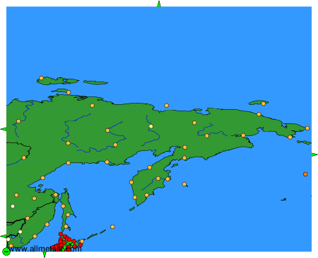
Climatic data of more than 3000 weather stations.
The available stations are represented by yellow and red dots on the map.
Hover mouse over dot to see the name of the station.
Then click to see the data.
To change the map : click on the green buttons with a black cross to zoom in, on the green button with a dash to zoom out, or on the green arrows for adjacent maps.