Climate normals
Climate :
Singkaling Hkamti
Agra
Allahabad
Aranyaprathet
Bangkok
Bangkok
Bhamo
Bhubaneswar
Bhumibol Dam
Chaiyaphum
Chanthaburi
Chennai
Cherrapunji
Chiang Mai
Chiang Rai
Chonburi
Chumphon
Coco Islands
Daltonganj
Darbhanga
Dawei
Dibrugarh
Dumka
Guwahati
Homalin
Hpa-An
Hua Hin
Hyderabad
Jagdalpur
Kalewa
Kanchanaburi
Kathar
Kengtung
Khlong Yai
Khon Kaen
Kolkata
Ko Sichang
Kunming
Kyaukpyu
Lampang
Lashio
Lhasa
Loei
Lopburi
Luang Prabang
Machilipatnam
Mae Hong Son
Mae Sariang
Mae Sot
Mandalay
Meiktila
Mergui
Mindat
Monywa
Mukteshwar
Myitkyina
Nagpur
Nakhon Ratchasima
Nakhon Sawan
Nan
Pathein
Phetchabun
Phitsanulok
Phrae
Port Blair
Prachinburi
Prachuap Khiri Khan
Putao
Pyay
Sagar
Sattahip
Singkaling Hkamti
Sittwe
Suphanburi
Tak
Taunggyi
Taungoo
Tengchong
Thandwe
Udon Thani
Uttaradit
Vientiane
Visakhapatnam
Xichang
Yangon
Ye
India, Nepal, Bhutan, Bangladesh, Myanmar
Asia
Cambodia
China
China, East
India
Indian Ocean islands
Laos
Malaysia
Sri Lanka
Thailand
Vietnam
Climate : Singkaling Hkamti, Myanmar latitude: 26-00N, longitude: 95-42E, elevation: m
Monthly average of the minimum and maximum daily temperatures.°C/°F
Precipitation is any kind of water that falls from the sky as part of the weather. This includes drizzle, rain, hail, sleet, or snow.mm/inch
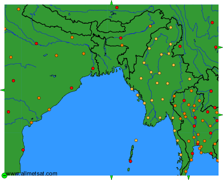
Climatic data of more than 3000 weather stations.
The available stations are represented by yellow and red dots on the map.
Hover mouse over dot to see the name of the station.
Then click to see the data.
To change the map : click on the green buttons with a black cross to zoom in, on the green button with a dash to zoom out, or on the green arrows for adjacent maps.