Climate normals
Climate :
Khasab
Abadan
Agdam
Arak
Ashgabat
Astara
Babolsar
Bahrain
Baku
Balkanabat
Bandar Abbas
Bandar-e Anzali
Bandar Lengeh
Bayram-Ali
Birjand
Bushehr
Chabahar
Dezful
Dhahran
Doha
Dubai
Erbent
Esenguly
Esfahān
Farah
Gyzyletrek
Hamedan
Herat
Iranshahr
Jiwani
Kerman
Kermanshah
Khasab
Khorramabad
Kuwait City
Lankaran
Mashhad
Maştağa
Nakhchivan
Nok Kundi
Pasni
Qala i Naw
Ramsar
Ras al-Khaimah
Rasht
Repatek
Riyadh
Salyan
Saragt
Semnan
Serdar
Serhetabat
Shahrood
Sharjah
Shiraz
Stepanakert
Tabriz
Tehran
Türkmenabat
Türkmenbaşy
Urmia
Yardymli
Yazd
Yerevan
Zahedan
Zanjan
Zaranj
Iran
Afghanistan
Africa
Armenia
Azerbaijan
Bahrain
Georgia
Iraq
Kazakhstan
Kuwait
Kyrgyzstan
Oman
Pakistan
Qatar
Saudi Arabia
Tajikistan
Turkey
Turkmenistan
United Arab Emirates
Uzbekistan
Climate : Khasab, Oman Khasab Airport
latitude: 26-13N, longitude: 056-14E, elevation: 10 ft
Monthly average of the minimum and maximum daily temperatures.°C/°F
Precipitation is any kind of water that falls from the sky as part of the weather. This includes drizzle, rain, hail, sleet, or snow.mm/inch
Climatic data of more than 3000 weather stations.
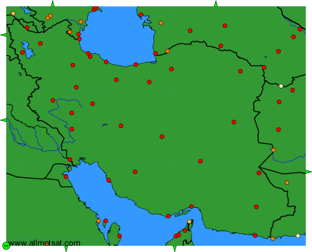
The available stations are represented by yellow and red dots on the map.
Hover mouse over dot to see the name of the station.
Then click to see the data.
To change the map : click on the green buttons with a black cross to zoom in, on the green button with a dash to zoom out, or on the green arrows for adjacent maps.
