Climate normals
Climate :
Taunggyi
Aranyaprathet
Bangkok
Bangkok
Bhumibol Dam
Chaiyaphum
Chanthaburi
Chiang Mai
Chiang Rai
Chonburi
Chumphon
Coco Islands
Dawei
Guangzhou
Haikou
Hong Kong
Hpa-An
Hua Hin
Kalewa
Kanchanaburi
Kathar
Kawthaung
Kengtung
Khlong Yai
Khon Kaen
Ko Sichang
Kota Bharu
Kyaukpyu
Lampang
Lashio
Loei
Lopburi
Luang Prabang
Mae Hong Son
Mae Sariang
Mae Sot
Mandalay
Meiktila
Mergui
Mindat
Monywa
Mukdahan
Nakhon Phanom
Nakhon Ratchasima
Nakhon Sawan
Nakhon Si Thammarat
Nan
Nanning
Narathiwat
Pakxe
Pathein
Penang
Phetchabun
Phitsanulok
Phrae
Phuket
Phuket
Pingbian
Port Blair
Prachinburi
Prachuap Khiri Khan
Pyay
Ranong
Roi Et
Sakon Nakhon
Sattahip
Savannakhet
Sittwe
Songkhla
Suphanburi
Surat Thani
Surin
Tak
Taunggyi
Taungoo
Thandwe
Trang
Ubon Ratchathani
Udon Thani
Uttaradit
Vientiane
Yangon
Ye
Thailand, Cambodia, Laos, Vietnam
Asia
Bangladesh
Bhutan
China
China, East
Hong Kong
India
Indian Ocean islands
India, Northeast
Indonesia
Macau
Malaysia
Myanmar
Nepal
Philippines
Sri Lanka
Climate : Taunggyi, Myanmar latitude: 20-47N, longitude: 97-03E, elevation: m
Monthly average of the minimum and maximum daily temperatures.°C/°F
Precipitation is any kind of water that falls from the sky as part of the weather. This includes drizzle, rain, hail, sleet, or snow.mm/inch
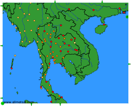
Climatic data of more than 3000 weather stations.
The available stations are represented by yellow and red dots on the map.
Hover mouse over dot to see the name of the station.
Then click to see the data.
To change the map : click on the green buttons with a black cross to zoom in, on the green button with a dash to zoom out, or on the green arrows for adjacent maps.