Climate normals
Climate :
Kadoma
Binga
Blantyre
Bvumbwe
Chinhoyi
Chipata
Chitedze
Chitipa
Chivhu
Choma
Dedza
Gokwe
Guruve
Harare
Harare (Belvedere)
Hernderson
Hwange National Park
Isoka
Kabompo
Kabwe
Kabwe Agric
Kadoma
Kafironda
Kafue Polder
Kaoma
Kariba
Karoi
Karonga
Kasama
Kasempa
Kawambwa
Kwekwe
Livingstone
Lundazi
Lusaka
Lusaka City
Magoye
Makanga
Mangochi
Mansa
Mbala
Mbeya
Mfuwe
Mimosa
Misamfu
Mongu
Mount Darwin
Mount Makulu
Mpika
Mukandi
Mumbwa
Mutoko
Mvurwi
Mwinilunga
Mzimba
Mzuzu
Ndola
Nkhata Bay
Nkhotakota
Petauke
Rusape
Salima
Senanga
Serenje
Sesheke
Solwezi
Songea
Thyolo
Victoria Falls
Wedza
Zambezi
Zambia, Malawi
Africa
Angola
Botswana
Burundi
Congo
Mozambique
Rwanda
Tanzania
Zimbabwe
Climate : Kadoma, Zimbabwe latitude: 18-19S, longitude: 29-53E, elevation: 1157 m
Precipitation is any kind of water that falls from the sky as part of the weather. This includes drizzle, rain, hail, sleet, or snow.mm/inch
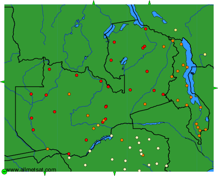
Climatic data of more than 3000 weather stations.
The available stations are represented by yellow and red dots on the map.
Hover mouse over dot to see the name of the station.
Then click to see the data.
To change the map : click on the green buttons with a black cross to zoom in, on the green button with a dash to zoom out, or on the green arrows for adjacent maps.