METAR-TAF
Airports :
Kano
Abidjan
Accra
Algiers
Amman
Ankara Esenboğa
Antananarivo
Athens
Baghdad
Bahrain
Bamako
Bangui
Beirut
Bujumbura
Cairo
Cape Town
Conakry
Dakar
Damascus
Dar es Salaam
Djibouti
Dubai
Funchal
Georgetown
Gibraltar
Gran Canaria
Harare
Istanbul Atatürk
Jeddah
Johannesburg
Karachi
Khartoum
Kinshasa
Kuwait City
Lagos
Larnaca
Libreville
Lisbon
Luanda
Lusaka
Madrid
Malabo
Maputo
Mauritius
Moroni
Nairobi-Jomo Kenyatta
N'Djamena
Niamey
Nouakchott
Ouagadougou
Palma de Mallorca
Pointe-Noire
Ponta Delgada
Rabat
Saint-Denis
Sana'a
Tehran
Tel Aviv
Tripoli
Tunis
Victoria
Yaoundé
Africa
Algeria
Algeria, North
Angola
Armenia
Asia
Azerbaijan
Azores
Bahrain
Benin
Botswana
Burkina Faso
Burundi
Cameroon
Canary Islands
Cape Verde
Central African Republic
Chad
Comoros
Congo
Cyprus
Djibouti
Egypt
Equatorial Guinea
Eritrea
Ethiopia
Europe
Gabon
Gambia
Georgia
Ghana
Greece
Guinea
Guinea-Bissau
Indian Ocean
Iran
Iraq
Israel
Ivory coast
Jordan
Kenya
Kuwait
Lebanon
Liberia
Libya
Madagascar
Madeira
Malawi
Mali
Mauritania
Mauritius
Morocco
Mozambique
Namibia
Niger
Nigeria
North Atlantic
Oman
Palestine
Portugal
Qatar
Réunion
Rwanda
São Tomé and Príncipe
Saudi Arabia
Senegal
Sierra Leone
Somalia
South Africa
South Africa, Gauteng
South America
South Atlantic
Spain
Sudan
Syria
Tanzania
Togo
Tunisia
Turkey
Uganda
United Arab Emirates
Yemen
Zambia
Zimbabwe
Mallam Aminu Kano International Airport Kano, Nigeria
latitude: 12-03N, longitude: 008-32E, elevation: 476 m
METAR: missing
Time: 05:40 (04:40 UTC) Forecast The report was made 17 hours and 40 minutes ago, at 11:00 UTC
Forecast valid from 28 at 12 UTC to 29 at 18 UTC
Wind 7 kt from the Southwest
Visibility 10 km or more
Few clouds at a height of 1300 ft
Temporary
Broken clouds at a height of 1200 ft Few clouds at a height of 2000 ft, Cumulonimbus.
thunderstorm
TAF: DNKN 281100Z 2812/2918 22007KT 9999 FEW013 TEMPO 2815/2820 TS BKN012 FEW020CB
Weather observations and forecasts of more than 4000 airports (METAR and TAF reports).
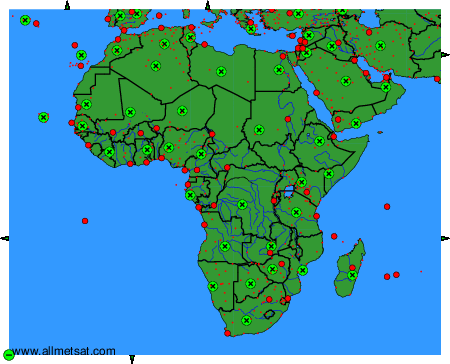
The available stations are represented by yellow and red dots on the map.
Hover mouse over dot to see the name of the station.
Then click to see weather observations and forecasts.
To change the map : click on the green buttons with a black cross to zoom in, on the green button with a dash to zoom out, or on the green arrows for adjacent maps.