METAR-TAF
Airports :
Palmer
Anchorage
Anchorage
Anchorage
Anchorage Elmendorf
Chugiak
Chulitna
Cordova
Delta Junction / Fort Greely
Eureka
Fairbanks
Fairbanks Eielson
Fort Richardson
Gulkana
Homer
Kenai
McKinley Park
Middleton Island
Nenana
Palmer
Portage Glacier
Seldovia
Seward
Skwentna
Soldotna
Talkeetna
Valdez
Wainwright
Wasilla
Alaska, Anchorage Fairbanks
Alaska
Alaska, Anchorage
Palmer Municipal Airport Palmer, Alaska, United States
latitude: 61-36N, longitude: 149-05W, elevation: 243 ft
Current weather observation The report was made 9 minutes ago, at 06:53 UTC
Wind 6 mph from the North
Temperature 27 °F
Humidity 93 %
Pressure 29.09 in. Hg
Visibility: 3 miles
Overcast at a height of 3400 ft
light snow, mist
METAR: PAAQ 070653Z AUTO 35005KT 3SM -SN BR OVC034 M03/M04 A2909 RMK AO2 SLP855 P0001 T10281044 TSNO
Time: 22:02 (07:02 UTC) Forecast The report was made 1 hour and 28 minutes ago, at 05:34 UTC
Forecast valid from 07 at 06 UTC to 08 at 06 UTC
Wind 5 mph from the West/Northwest
Visibility: 1 miles
Overcast at a height of 1500 ft
light snow
Temporary
Visibility: 0.5 miles
Overcast at a height of 900 ft
light snow, fog
From 07 at 1200 UTC
Wind 8 mph from the South/Southwest
Visibility: 6 miles
Scattered clouds at a height of 1500 ft Overcast at a height of 3500 ft
light snow showers
From 07 at 1800 UTC
Wind 0 mph from the North
Visibility: 6 miles
Overcast at a height of 5000 ft
showers in vicinity
TAF: PAAQ 070534Z 0706/0806 29004KT 1SM -SN OVC015 TEMPO 0706/0710 1/2SM -SN FG OVC009 FM071200 20007KT 6SM -SHSN SCT015 OVC035 FM071800 00000KT P6SM VCSH OVC050
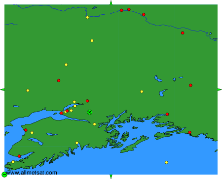
Weather observations and forecasts of more than 4000 airports (METAR and TAF reports).
The available stations are represented by yellow and red dots on the map.
Hover mouse over dot to see the name of the station.
Then click to see weather observations and forecasts.
To change the map : click on the green buttons with a black cross to zoom in, on the green button with a dash to zoom out, or on the green arrows for adjacent maps.