METAR-TAF
Airports :
Elmendorf Air Force Base
Anchorage Elmendorf, Alaska, United States
latitude: 61-15-11N, longitude: 149-47-38W, elevation: 213 ft
Current weather observation
Overcast at a height of 5000 ft
METAR: PAED 210055Z 01004KT 6SM -RA SCT004 OVC050 13/12 A3005 RMK AO2A SLP172 P0006 T01340121 $
Time: 17:59 (01:59 UTC)
Forecast
Overcast at a height of 4500 ft
from 20 at 21 UTC to 20 at 22 UTC
from 21 at 01 UTC to 21 at 02 UTC
Overcast at a height of 3000 ft
from 21 at 07 UTC to 21 at 08 UTC
Overcast at a height of 3000 ft
from 21 at 17 UTC to 21 at 18 UTC
from 21 at 21 UTC to 21 at 22 UTC
TAF: PAED 202100Z 2021/2203 01006KT 9000 -RA FEW004 OVC045 620709 QNH3004INS BECMG 2021/2022 35006KT 8000 -RA OVC004 620709 QNH3004INS BECMG 2101/2102 VRB06KT 8000 -SHRA BKN010 OVC030 650709 QNH3006INS BECMG 2107/2108 VRB06KT 6000 BR SCT015 OVC030 620603 QNH3011INS BECMG 2117/2118 35006KT 9999 NSW OVC050 620603 QNH3010INS BECMG 2121/2122 35009KT 9000 -SHRA OVC040 650709 QNH3008INS TX15/2121Z TN10/2113Z
Weather observations and forecasts of more than 4000 airports (METAR and TAF reports).
The available stations are represented by yellow and red dots on the map.
Hover mouse over dot to see the name of the station.
Then click to see weather observations and forecasts.
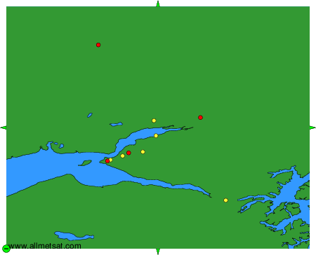
To change the map : click on the green buttons with a black cross to zoom in, on the green button with a dash to zoom out, or on the green arrows for adjacent maps.