METAR-TAF
Airports :
Ted Stevens Anchorage International Airport
Anchorage, Alaska, United States
latitude: 61-10-28N, longitude: 149-59-46W, elevation: 44 m
Current weather observation
The report was made 24 minutes ago, at 08:53 UTC
Wind 7 kt from the West/Southwest
Temperature 12°C
Humidity 71%
Pressure 1013 hPa
Visibility: 16.1 km
Few clouds at a height of 6000 ft
METAR: PANC 250853Z 24007KT 10SM FEW060 12/07 A2990 RMK AO2 SLP124 T01170067 401670083 58004
Time: 01:17 (09:17 UTC)
Forecast
The report was made 3 hours and 56 minutes ago, at 05:21 UTC
Forecast valid from 25 at 06 UTC to 26 at 12 UTC
Wind 6 kt from the West
Visibility: 10 km
Broken clouds at a height of 7000 ft
showers in vicinity
From 25 at 0800 UTC
Wind 5 kt from the South/Southwest
Visibility: 10 km
Scattered clouds at a height of 8000 ft
From 25 at 2200 UTC
Wind 9 kt from the West
Visibility: 10 km
Few clouds at a height of 5000 ft
Broken clouds at a height of 20000 ft
Broken clouds at a height of 20000 ft
TAF: PANC 250521Z 2506/2612 28006KT P6SM VCSH BKN070 FM250800 21005KT P6SM SCT080 FM252200 28009KT P6SM FEW050 BKN200
Weather observations and forecasts of more than 4000 airports (METAR and TAF reports).
The available stations are represented by yellow and red dots on the map.
Hover mouse over dot to see the name of the station.
Then click to see weather observations and forecasts.
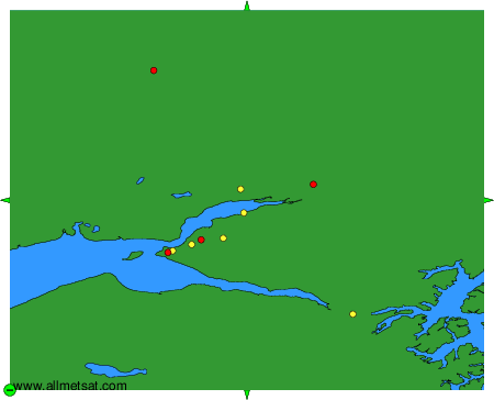
To change the map : click on the green buttons with a black cross to zoom in, on the green button with a dash to zoom out, or on the green arrows for adjacent maps.