METAR-TAF
Airports :
Ketchikan
Angoon
Annette Island
Bella Bella
Bella Coola
Cathedral Point
Cumshewa Island
Dease Lake
Estevan Point
Grey Islet
Gustavus
Haines
Herbert Island
Holland Rock
Hoonah
Hydaburg
Juneau
Kake
Ketchikan
Kindakun Rocks
Klawock
Langara Island
Lucy Island
Masset
Metlakatla
Petersburg
Port Alexander
Port Hardy
Prince Rupert
Rose Spit
Sandspit
Sitka
Skagway
Smithers
Solander Islands
Stewart
Terrace
Wrangell
Yakutat
Alaska, British Columbia
Alaska
British Columbia
North America
North Pacific
Northwest Territories
Yukon
Ketchikan International Airport Ketchikan, Alaska, United States
latitude: 55-21-20N, longitude: 131-42-49W, elevation: 89 ft
Current weather observation The report was made 20 minutes ago, at 21:53 UTC
Calm wind
Temperature 32 °F
Humidity 80 %
Pressure 29.88 in. Hg
Visibility: 10 miles
Few clouds at a height of 3200 ft Broken clouds at a height of 5500 ft
METAR: PAKT 262153Z 00000KT 10SM FEW032 BKN055 00/M03 A2988 RMK AO2 SLP121 T00001033 PNO $
Time: 13:13 (22:13 UTC) Forecast The report was made 4 hours and 41 minutes ago, at 17:32 UTC
Forecast valid from 26 at 18 UTC to 27 at 18 UTC
Wind 6 mph from the South/Southeast
Visibility: 6 miles
Scattered clouds at a height of 2000 ft Broken clouds at a height of 3000 ft Overcast at a height of 6000 ft
light snow showers
Probability 30%
Visibility: 3 miles
Broken clouds at a height of 1500 ft Overcast at a height of 2500 ft
light snow showers
From 27 at 0300 UTC
Wind 5 mph from variable directions
Visibility: 6 miles
Scattered clouds at a height of 3500 ft Overcast at a height of 6000 ft
light snow showers
From 27 at 1200 UTC
Wind 5 mph from the South/Southeast
Visibility: 6 miles
Overcast at a height of 5000 ft
TAF: PAKT 261732Z 2618/2718 15005KT 6SM -SHSN SCT020 BKN030 OVC060 PROB30 2618/2624 3SM -SHSN BKN015 OVC025 FM270300 VRB04KT 6SM -SHSN SCT035 OVC060 FM271200 15004KT P6SM OVC050 AMD LTD TO CLD VIS AND WIND 2706/2715
Weather observations and forecasts of more than 4000 airports (METAR and TAF reports).
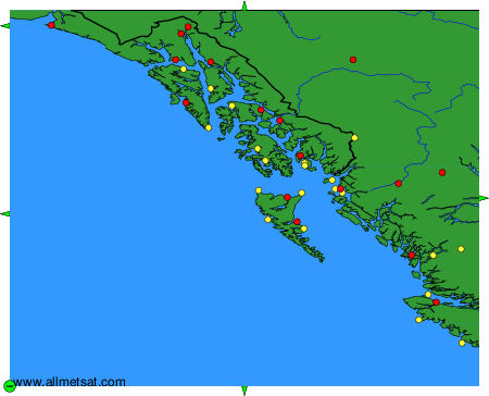
The available stations are represented by yellow and red dots on the map.
Hover mouse over dot to see the name of the station.
Then click to see weather observations and forecasts.
To change the map : click on the green buttons with a black cross to zoom in, on the green button with a dash to zoom out, or on the green arrows for adjacent maps.
