METAR-TAF
Airports :
Bettles Airport
Bettles, Alaska, United States
latitude: 66-55N, longitude: 151-31W, elevation: 643 ft
Current weather observation
The report was made 21 minutes ago, at 01:53 UTC
Wind 8 mph from the West/Southwest
Temperature 43°F
Humidity 75%
Pressure 29.79 in. Hg
Visibility: 10 miles
Few clouds at a height of 2200 ft
Broken clouds at a height of 5000 ft
Broken clouds at a height of 9000 ft
Broken clouds at a height of 5000 ft
Broken clouds at a height of 9000 ft
METAR: PABT 130153Z 25007KT 10SM FEW022 BKN050 BKN090 06/02 A2979 RMK AO2 SLP099 SHRA VC SW T00610017 $
Time: 18:14 (02:14 UTC)
Forecast
The report was made 2 hours and 52 minutes ago, at 23:22 UTC
Forecast valid from 13 at 00 UTC to 13 at 24 UTC
Wind 7 mph from the South/Southwest
Visibility: 6 miles
Scattered clouds at a height of 2500 ft
Overcast at a height of 5000 ft
Overcast at a height of 5000 ft
showers in vicinity
From 13 at 1200 UTC
Wind 5 mph from variable directions
Visibility: 6 miles
Scattered clouds at a height of 5000 ft
Broken clouds at a height of 10000 ft
Broken clouds at a height of 10000 ft
TAF: PABT 122322Z 1300/1324 20006KT P6SM VCSH SCT025 OVC050 FM131200 VRB04KT P6SM SCT050 BKN100
Weather observations and forecasts of more than 4000 airports (METAR and TAF reports).
The available stations are represented by yellow and red dots on the map.
Hover mouse over dot to see the name of the station.
Then click to see weather observations and forecasts.
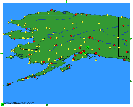
To change the map : click on the green buttons with a black cross to zoom in, on the green button with a dash to zoom out, or on the green arrows for adjacent maps.