METAR-TAF
Airports :
Kodiak
Akhiok
Ambler
Anaktuvuk Pass
Anchorage
Anchorage
Anchorage
Anchorage Elmendorf
Aniak
Anvik
Arctic Village
Atqasuk
Barrow
Barter Island
Beaver Creek
Bethel
Bettles
Brevig Mission
Buckland
Burwash
Cape Lisburne
Cape Newenham
Cape Romanzof
Chevak
Chignik
Chugiak
Chulitna
Clark's Point
Cold Bay
Cordova
Dawson City
Deadhorse
Deadhorse
Deering
Delta Junction / Fort Greely
Dillingham
Eagle
Egegik
Elim
Emmonak
Eureka
Fairbanks
Fairbanks Eielson
False Pass
Fort Richardson
Fort Yukon
Galbraith Lake
Galena
Golovin
Gulkana
Homer
Hooper Bay
Huslia
Igiugig
Iliamna
Kalskag
Kaltag
Kenai
Kiana
King Cove
King Salmon
Kivalina
Kodiak
Koliganek
Komakuk Beach
Kotzebue
Koyuk
Kuparuk
Kwethluk
Lake Minchumina
Manokotak
Marshall
McGrath
McKinley Park
Mekoryuk
Middleton Island
Mountain Village
Nabesna
Napakiak
Nelson Lagoon
Nenana
New Stuyahok
Nikolai
Noatak
Nome
Noorvik
Northway
Nuiqsut
Old Crow
Palmer
Pilot Point
Platinum
Point Hope
Point Lay
Portage Glacier
Port Alsworth
Port Heiden
Puntilla
Quinhagak
Red Dog Mine
Ruby
Russian Mission
Sand Point
Scammon Bay
Selawik
Seldovia
Seward
Shageluk
Shishmaref
Shungnak
Skwentna
Sleetmute
Soldotna
South Naknek
Sparrevohn
St Mary's
St. Michael
Talkeetna
Tanana
Tatalina
Teller
Tin City
Togiak Village
Unalakleet
Unalaska
Utopia Creek
Valdez
Wainwright
Wainwright
Wales
Wasilla
White Mountain
Yakutat
Alaska
Alaska, Anchorage
Alaska, Anchorage Fairbanks
Alaska, British Columbia
Arctic Ocean
Bering Sea
Hawaii
North America
Northwest Territories
Yukon
Kodiak Airport Kodiak, Alaska, United States
latitude: 57-45N, longitude: 152-30W, elevation: 72 ft
Current weather observation The report was made 2 hours and 4 minutes ago, at 06:53 UTC
Calm wind
Temperature 54 °F
Humidity 88 %
Pressure 30.05 in. Hg
Visibility: 10 miles
Clear sky
METAR: PADQ 020653Z AUTO 00000KT 10SM CLR 12/10 A3005 RMK AO2 SLP175 T01170100 $
Time: 00:57 (08:57 UTC) Forecast The report was made 3 hours and 26 minutes ago, at 05:31 UTC
Forecast valid from 02 at 06 UTC to 03 at 06 UTC
Wind 6 mph from the Northeast
Visibility: 6 miles
Clear sky
From 02 at 0800 UTC
Wind 6 mph from the West
Visibility: 6 miles
Scattered clouds at a height of 600 ft Scattered clouds at a height of 1500 ft
fog in vicinity
From 02 at 1300 UTC
Wind 5 mph from the West
Visibility: 6 miles
Scattered clouds at a height of 300 ft Overcast at a height of 500 ft
mist
From 02 at 2000 UTC
Wind 8 mph from the East
Visibility: 6 miles
Few clouds at a height of 1000 ft Overcast at a height of 4000 ft
TAF: PADQ 020531Z 0206/0306 05005KT P6SM SKC FM020800 28005KT P6SM VCFG SCT006 SCT015 FM021300 26004KT 6SM BR SCT003 OVC005 FM022000 10007KT P6SM FEW010 OVC040
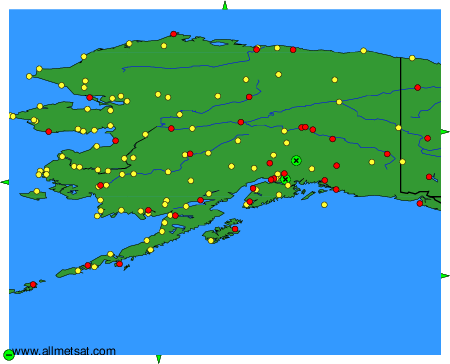
Weather observations and forecasts of more than 4000 airports (METAR and TAF reports).
The available stations are represented by yellow and red dots on the map.
Hover mouse over dot to see the name of the station.
Then click to see weather observations and forecasts.
To change the map : click on the green buttons with a black cross to zoom in, on the green button with a dash to zoom out, or on the green arrows for adjacent maps.