METAR-TAF
Airports :
King Salmon Airport
King Salmon, Alaska, United States
latitude: 58-40-36N, longitude: 156-38-57W, elevation: 56 ft
Current weather observation
The report was made 12 minutes ago, at 14:54 UTC
Temperature
Pressure 29.57 in. Hg
METAR: PAKN 051454Z AUTO A2957 RMK AO2 SLPNO 51028 PWINO FZRANO TSNO RVRNO
Time: 07:06 (15:06 UTC)
Forecast
The report was made 3 hours and 37 minutes ago, at 11:29 UTC
Forecast valid from 05 at 12 UTC to 06 at 12 UTC
Wind 6 mph from variable directions
Visibility: 6 miles
Overcast at a height of 3000 ft
showers in vicinity
From 05 at 2200 UTC
Wind 10 mph from the West/Northwest
Visibility: 5 miles
Scattered clouds at a height of 700 ft
Overcast at a height of 1500 ft
Overcast at a height of 1500 ft
light rain showers, mist
From 06 at 0800 UTC
Wind 5 mph from variable directions
Visibility: 6 miles
Scattered clouds at a height of 2500 ft
Broken clouds at a height of 4000 ft
Broken clouds at a height of 4000 ft
TAF: PAKN 051129Z 0512/0612 VRB05KT P6SM VCSH OVC030 FM052200 30009KT 5SM -SHRA BR SCT007 OVC015 FM060800 VRB04KT P6SM SCT025 BKN040
Weather observations and forecasts of more than 4000 airports (METAR and TAF reports).
The available stations are represented by yellow and red dots on the map.
Hover mouse over dot to see the name of the station.
Then click to see weather observations and forecasts.
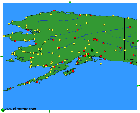
To change the map : click on the green buttons with a black cross to zoom in, on the green button with a dash to zoom out, or on the green arrows for adjacent maps.