METAR-TAF
Airports :
High Level
Agassiz
Banff
Banff
Blue River
Bow Island
Bow Valley
Brooks
Buffalo Narrows
Buffalo Narrows
Calgary
Calgary-Springbank
Cardston
Castlegar
Chetwynd
Claresholm
Clinton
Cold Lake
Coronation
Cranbrook
Creston
Crowsnest Pass
Cut Bank
Cypress Hills
Dawson Creek
Drumheller
Eastend Cypress
Edmonton
Edmonton
Edmonton Namao
Edson
Esther
Fort Chipewyan
Fort McMurray
Fort St. John
Golden
Grande Prairie
Havre
High Level
Hope
Jasper
Jimmy Lake
Kalispell Glacier Park
Kamloops
Kelowna
Kindersley
Lac La Biche
Leader
Lethbridge
Lloydminster
Lucky Lake
Lytton
Maple Creek
Meadow Lake
Medicine Hat
Milk River
Nakusp
Nelson
North Battleford
Omak
Onefour
Osoyoos
Peace River
Penticton
Pincher Creek
Princeton
Princeton
Red Deer
Revelstoke
Rocky Mountain House
Rosetown
Salmon Arm
Sandpoint
Slave Lake
Sparwood
Sparwood
Spirit River
Spiritwood
Suffield
Summerland
Sundre
Swift Current
Three Hills
Uranium City
Val Marie
Vegreville
Vernon
Villeneuve
Waterton Park Gate
Whitecourt
Yoho National Park
Alberta
British Columbia
Idaho
Montana, East
Montana, West
North America
Northwest Territories
Nunavut
Saskatchewan
Washington
Yukon
High Level Airport High Level, Alberta, Canada
latitude: 58-37N, longitude: 117-10W, elevation: 338 m
Current weather observation The report was made 29 minutes ago, at 15:00 UTC
Wind 5 kt from the Southeast
Temperature 15 °C
Humidity 67 %
Pressure 1020 hPa
Visibility: 24.1 km
Few clouds at a height of 4000 ft Few clouds at a height of 14000 ft Few clouds at a height of 26000 ft
METAR: CYOJ 221500Z 14005KT 15SM FEW040 FEW140 FEW260 15/09 A3012 RMK CU1AC1CI1 CI TR WIND EST SLP212
Time: 09:29 (15:29 UTC) Forecast The report was made 14 hours and 49 minutes ago, at 00:40 UTC
Forecast valid from 22 at 01 UTC to 22 at 13 UTC
Wind 3 kt from variable directions
Visibility: 10 km
Scattered clouds at a height of 7000 ft Broken clouds at a height of 12000 ft
Temporary
Broken clouds at a height of 7000 ft
From 22 at 0300 UTC
Wind 3 kt from variable directions
Visibility: 10 km
Scattered clouds at a height of 6000 ft
Probability 30%
Visibility: 3.2 km
mist
TAF: CYOJ 220040Z 2201/2213 VRB03KT P6SM SCT070 BKN120 TEMPO 2201/2203 BKN070 FM220300 VRB03KT P6SM SCT060 PROB30 2209/2213 2SM BR RMK NXT FCST BY 220700Z
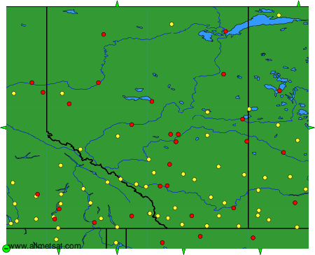
Weather observations and forecasts of more than 4000 airports (METAR and TAF reports).
The available stations are represented by yellow and red dots on the map.
Hover mouse over dot to see the name of the station.
Then click to see weather observations and forecasts.
To change the map : click on the green buttons with a black cross to zoom in, on the green button with a dash to zoom out, or on the green arrows for adjacent maps.