METAR-TAF
Airports :
Yellowknife
Anchorage
Arkhangelsk
Fairbanks
Helsinki
Iqaluit
Kangerlussuaq
Longyearbyen
Murmansk
Oslo
Resolute
Reykjavík
Thule
Yakutsk
Yellowknife
Arctic Ocean
Alaska
Alaska, Anchorage
Alaska, Anchorage Fairbanks
Asia
Bering Sea
Central Siberia
Eastern Siberia
Europe
Faroe Islands
Finland
Greenland
Iceland
North America
North Atlantic
North Pacific
North Sea
Northwest Territories
Norway
Nunavut
Nunavut, Baffin Island, Ellesmere
Scandinavia, Southwest
Shetland
Sweden
Western Siberia
Yukon
Yellowknife Airport Yellowknife, Northwest Territories, Canada
latitude: 62-28N, longitude: 114-27W, elevation: 205 m
Current weather observation The report was made 12 minutes ago, at 06:00 UTC
Wind 7 kt from the West/Northwest
Temperature -23 °C
Humidity 76 %
Pressure 1031 hPa
Visibility: 24.1 km
Scattered clouds at a height of 24000 ft
METAR: CYZF 260600Z 29007KT 15SM SCT240 M23/M26 A3045 RMK CI4 SLP345
Time: 00:12 (06:12 UTC) Forecast The report was made 32 minutes ago, at 05:40 UTC
Forecast valid from 26 at 06 UTC to 27 at 12 UTC
Wind 6 kt from the West
Visibility: 10 km
Scattered clouds at a height of 24000 ft
From 26 at 0900 UTC
Wind 6 kt from the West/Northwest
Visibility: 10 km
Scattered clouds at a height of 4000 ft
Temporary
Visibility: 8.0 km
Broken clouds at a height of 1500 ft Broken clouds at a height of 4000 ft
light snow
From 27 at 0300 UTC
Wind 8 kt from the West
Visibility: 10 km
Few clouds at a height of 1500 ft
TAF: CYZF 260540Z 2606/2712 28006KT P6SM SCT240 FM260900 29006KT P6SM SCT040 TEMPO 2609/2703 5SM -SN BKN015 BKN040 FM270300 27008KT P6SM FEW015 RMK NXT FCST BY 260900Z
Weather observations and forecasts of more than 4000 airports (METAR and TAF reports).
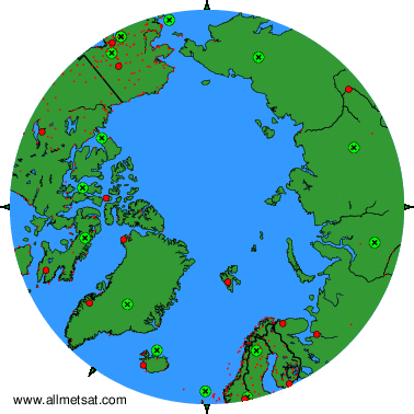
The available stations are represented by yellow and red dots on the map.
Hover mouse over dot to see the name of the station.
Then click to see weather observations and forecasts.
To change the map : click on the green buttons with a black cross to zoom in, on the green button with a dash to zoom out, or on the green arrows for adjacent maps.
