METAR-TAF
Airports :
Arkhangelsk
Anchorage
Arkhangelsk
Fairbanks
Helsinki
Iqaluit
Kangerlussuaq
Longyearbyen
Murmansk
Oslo
Resolute
Reykjavík
Thule
Yakutsk
Yellowknife
Arctic Ocean
Alaska
Alaska, Anchorage
Alaska, Anchorage Fairbanks
Asia
Bering Sea
Central Siberia
Eastern Siberia
Europe
Faroe Islands
Finland
Greenland
Iceland
North America
North Atlantic
North Pacific
North Sea
Northwest Territories
Norway
Nunavut
Nunavut, Baffin Island, Ellesmere
Scandinavia, Southwest
Shetland
Sweden
Western Siberia
Yukon
Talagi Airport Arkhangelsk, Russia
latitude: 64-30N, longitude: 040-44E, elevation: 13 m
Current weather observation The report was made 26 minutes ago, at 05:30 UTC
Wind 4 kt from the East
Temperature -22 °C
Humidity 84 %
Pressure 998 hPa
Visibility: 7000 m
Broken clouds at a height of 700 ft
light snow
METAR: ULAA 120530Z 08002MPS 7000 -SN BKN007 M22/M24 Q0998 R08/490536 NOSIG RMK QFE747/0996
Time: 08:56 (05:56 UTC) Forecast The report was made 56 minutes ago, at 05:00 UTC
Forecast valid from 12 at 06 UTC to 13 at 06 UTC
Wind 4 kt from the East
Visibility 10 km or more
Scattered clouds at a height of 500 ft Broken clouds at a height of 1300 ft
Temporary
Wind 6 kt from the East/Northeast
Visibility: 6000 m
Broken clouds at a height of 400 ft Broken clouds at a height of 1100 ft, Cumulonimbus.
light snow showers
Temporary
Wind 2 kt from variable directions
Visibility: 4000 m
Broken clouds at a height of 400 ft
mist
TAF: ULAA 120500Z 1206/1306 10002MPS 9999 SCT005 BKN013 TEMPO 1206/1221 07003MPS 6000 -SHSN BKN004 BKN011CB TEMPO 1221/1306 VRB01MPS 4000 BR BKN004
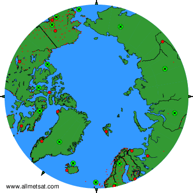
Weather observations and forecasts of more than 4000 airports (METAR and TAF reports).
The available stations are represented by yellow and red dots on the map.
Hover mouse over dot to see the name of the station.
Then click to see weather observations and forecasts.
To change the map : click on the green buttons with a black cross to zoom in, on the green button with a dash to zoom out, or on the green arrows for adjacent maps.
