METAR-TAF
Airports :
Nellis
Blythe
Boulder City
Buckeye
Bullhead City
Casa Grande
Chandler
Colorado City
Cortez
Douglas / Bisbee
El Centro
Farmington
Flagstaff
Fort Huachuca / Sierra Vista
Gallup
Glendale
Glendale
Goodyear
Grand Canyon
Henderson
Imperial
Indian Springs
Kingman
Lake Havasu City
Las Vegas
Mesa
Mesa
Mexicali
Needles
Nellis
Nogales
North Las Vegas
Page
Payson
Phoenix
Phoenix
Prescott
Puerto Peñasco
Safford
Scottsdale
Sedona
Show Low
Silver City
St. George
St. Johns
Tucson
Tucson
Tucson
Tucson
Window Rock
Winslow
Yuma
Arizona
California, South
Colorado
Mexico, Northeast
Mexico, Northwest
Nevada
New Mexico
North America
Utah
Nellis Air Force Base Nellis, Nevada, United States
latitude: 36-14N, longitude: 115-02W, elevation: 1870 ft
Current weather observation The report was made 32 minutes ago, at 18:55 UTC
Wind 5 mph from the West/Southwest
Temperature 70 °F
Humidity 28 %
Pressure 29.94 in. Hg
Visibility: 10 miles
Scattered clouds at a height of 25000 ft
METAR: KLSV 101855Z 24004KT 10SM SCT250 21/02 A2994 RMK AO2A SLP124 T02120024 $
Time: 12:27 (19:27 UTC) Forecast The report was made 4 hours and 27 minutes ago, at 15:00 UTC
Forecast valid from 10 at 15 UTC to 11 at 21 UTC
Wind 10 mph from the South/Southeast
Visibility 6.2 miles or more
Few clouds at a height of 25000 ft
Becoming
Wind 12 mph from the South with gusts up to 17 mph
Visibility 6.2 miles or more
Few clouds at a height of 15000 ft Few clouds at a height of 25000 ft
Becoming
Wind 7 mph from variable directions
Visibility 6.2 miles or more
Few clouds at a height of 25000 ft
Becoming
Wind 12 mph from the Northeast with gusts up to 17 mph
Visibility 6.2 miles or more
Few clouds at a height of 25000 ft
TAF: KLSV 101500Z 1015/1121 15009KT 9999 FEW250 QNH2986INS BECMG 1022/1023 19010G15KT 9999 FEW150 FEW250 QNH2988INS BECMG 1103/1104 VRB06KT 9999 FEW250 QNH2997INS BECMG 1116/1117 05010G15KT 9999 FEW250 QNH3024INS TX26/1023Z TN12/1114Z
Weather observations and forecasts of more than 4000 airports (METAR and TAF reports).
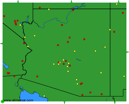
The available stations are represented by yellow and red dots on the map.
Hover mouse over dot to see the name of the station.
Then click to see weather observations and forecasts.
To change the map : click on the green buttons with a black cross to zoom in, on the green button with a dash to zoom out, or on the green arrows for adjacent maps.
