METAR-TAF
Airports :
Horn Island
Alice Springs
Cloncurry
Darwin
Gove Peninsula
Groote Eylandt
Horn Island
Katherine
Kununurra
Lake Argyle
Mount Isa
Normanton
Richmond
Tennant Creek
Uluru
Weipa
Northern Territory
Australia
Indonesia
Melanesia
Micronesia
Queensland
South Australia
Western Australia, North
Western Australia, South
Horn Island Airport Horn Island, Australia
latitude: 10-35-11S, longitude: 142-07-24E, elevation: 13 m
Current weather observation The report was made 38 minutes ago, at 17:30 UTC
Wind 12 kt from the South/Southeast
Temperature 25 °C
Humidity 83 %
Pressure 1011 hPa
Visibility 10 km or more
Broken clouds at a height of 1600 ft Broken clouds at a height of 2700 ft Overcast at a height of 3000 ft
METAR: YHID 011730Z AUTO 15012KT 9999 // BKN016 BKN027 OVC030 25/22 Q1011
Time: 04:08 (18:08 UTC) Forecast The report was made 1 hour and 1 minutes ago, at 17:07 UTC
Forecast valid from 01 at 18 UTC to 02 at 18 UTC
Wind 12 kt from the South/Southeast
Visibility 10 km or more
Broken clouds at a height of 1500 ft
light rain showers
From 02 at 0000 UTC
Wind 18 kt from the Southeast
Visibility 10 km or more
Scattered clouds at a height of 1500 ft Scattered clouds at a height of 2500 ft
light rain showers
From 02 at 0600 UTC
Wind 18 kt from the Southeast
Visibility 10 km or more
Scattered clouds at a height of 2000 ft
From 02 at 1000 UTC
Wind 14 kt from the South/Southeast
Visibility 10 km or more
Scattered clouds at a height of 2000 ft
TAF: YHID 011707Z 0118/0218 15012KT 9999 -SHRA BKN015 FM020000 13018KT 9999 -SHRA SCT015 SCT025 FM020600 13018KT 9999 NSW SCT020 FM021000 15014KT 9999 SCT020
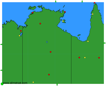
Weather observations and forecasts of more than 4000 airports (METAR and TAF reports).
The available stations are represented by yellow and red dots on the map.
Hover mouse over dot to see the name of the station.
Then click to see weather observations and forecasts.
To change the map : click on the green buttons with a black cross to zoom in, on the green button with a dash to zoom out, or on the green arrows for adjacent maps.