METAR-TAF
Airports :
Newcastle
Adelaide
Albury
Avalon
Ballina
Broken Hill
Canberra
Casino
Cobar
Coffs Harbour
Cooma
Coonabarabran
Coonamble
Dubbo
Grafton
Griffith
Hobart
Launceston
Leigh Creek
Lismore
Melbourne
Merimbula
Mildura
Moree
Mount Gambier
Mudgee
Narrabri
Narrandera
Newcastle
Nowra
Olympic Dam
Port Macquarie
Richmond
Sydney
Tamworth
Taree
Wagga Wagga
Wangaratta
Whyalla
Woomera
New South Wales, Victoria, Tasmania
Antarctica
Australia
Central Pacific
Queensland
South Australia
Newcastle Airport Newcastle, Australia
latitude: 32-47-42S, longitude: 151-50-04E, elevation: 9 m
Current weather observation The report was made 37 minutes ago, at 05:30 UTC
Wind 7 kt from the East/Southeast
Temperature 24 °C
Humidity 57 %
Pressure 1013 hPa
Visibility 10 km or more
no clouds below 1500 m and no cumulonimbus
METAR: YWLM 060530Z 12007KT CAVOK 24/15 Q1013
Time: 17:07 (06:07 UTC) Forecast The report was made 1 hour and 57 minutes ago, at 04:10 UTC
Forecast valid from 06 at 05 UTC to 07 at 00 UTC
Wind 10 kt from the East/Southeast
Visibility 10 km or more
no clouds below 1500 m and no cumulonimbus
From 06 at 0700 UTC
Wind 6 kt from the East/Northeast
Visibility 10 km or more
no clouds below 1500 m and no cumulonimbus
From 06 at 1000 UTC
Wind 3 kt from variable directions
Visibility 10 km or more
no clouds below 1500 m and no cumulonimbus
From 06 at 1300 UTC
Wind 20 kt from the South with gusts up to 30 kt
Visibility 10 km or more
Scattered clouds at a height of 1500 ft Broken clouds at a height of 2500 ft
light rain showers
From 06 at 2200 UTC
Wind 22 kt from the South with gusts up to 32 kt
Visibility 10 km or more
Scattered clouds at a height of 4500 ft
Temporary
Wind 25 kt from the South with gusts up to 35 kt
Visibility: 3000 m
Broken clouds at a height of 1000 ft
rain showers
TAF: YWLM 060410Z 0605/0700 11010KT CAVOK FM060700 07006KT CAVOK FM061000 VRB03KT CAVOK FM061300 18020G30KT 9999 -SHRA SCT015 BKN025 FM062200 18022G32KT 9999 NSW SCT045 TEMPO 0614/0621 18025G35KT 3000 SHRA BKN010
Weather observations and forecasts of more than 4000 airports (METAR and TAF reports).
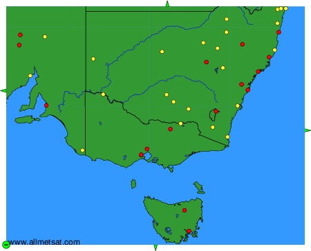
To change the map : click on the green buttons with a black cross to zoom in, on the green button with a dash to zoom out, or on the green arrows for adjacent maps.