METAR-TAF
Airports :
Mount Isa Airport
Mount Isa, Australia
latitude: 20-40S, longitude: 139-28E, elevation: 342 m
Current weather observation
The report was made 35 minutes ago, at 06:00 UTC
Wind 11 kt from the East/Northeast
Temperature 33°C
Humidity 53%
Pressure 1008 hPa
Visibility 10 km or more
Few clouds at a height of 5400 ft
METAR: YBMA 130600Z AUTO 07011KT 9999 // FEW054 33/22 Q1008
Time: 16:35 (06:35 UTC)
Forecast
The report was made 1 hour and 38 minutes ago, at 04:57 UTC
Forecast valid from 13 at 06 UTC to 13 at 18 UTC
Wind 12 kt from the East
Visibility 10 km or more
Scattered clouds at a height of 4500 ft
From 13 at 0900 UTC
Wind 8 kt from the East/Northeast
Visibility 10 km or more
Few clouds at a height of 4500 ft
From 13 at 1400 UTC
Wind 5 kt from the South/Southeast
Visibility 10 km or more
Few clouds at a height of 2500 ft
Probability 30% :
Temporary
from 13 at 06 UTC to 13 at 10 UTC
from 13 at 06 UTC to 13 at 10 UTC
Wind 15 kt from variable directions with gusts up to 30 kt
Visibility: 1000 m
Broken clouds at a height of 500 ft
Scattered clouds at a height of 4000 ft, Cumulonimbus.
Scattered clouds at a height of 4000 ft, Cumulonimbus.
thunderstorm, rain
TAF: YBMA 130457Z 1306/1318 08012KT 9999 SCT045 FM130900 06008KT 9999 FEW045 FM131400 15005KT 9999 FEW025 PROB30 TEMPO 1306/1310 VRB15G30KT 1000 TSRA BKN005 SCT040CB
Weather observations and forecasts of more than 4000 airports (METAR and TAF reports).
The available stations are represented by yellow and red dots on the map.
Hover mouse over dot to see the name of the station.
Then click to see weather observations and forecasts.
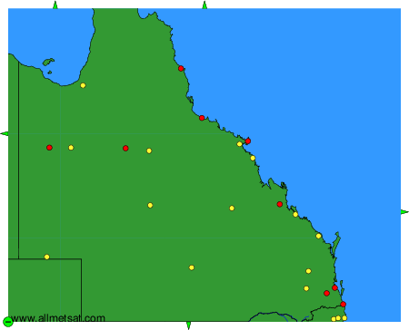
To change the map : click on the green buttons with a black cross to zoom in, on the green button with a dash to zoom out, or on the green arrows for adjacent maps.