METAR-TAF
Airports :
Canberra
Adelaide
Albany
Albury
Alice Springs
Alotau
Avalon
Ballina
Barrow Island
Birdsville
Brisbane
Broken Hill
Broome
Bullsbrook
Bundaberg
Cairns
Canberra
Carnarvon
Casino
Ceduna
Charleville
Cloncurry
Cobar
Coffs Harbour
Coober Pedy
Coolangatta
Cooma
Coonabarabran
Coonamble
Darwin
Denpasar
Derby
Derby
Dubbo
Emerald
Esperance
Exmouth
Forrest
Geraldton
Gladstone
Gove Peninsula
Grafton
Griffith
Groote Eylandt
Hamilton Island
Hobart
Horn Island
Hughenden
Ipswich
Jandakot
Kalgoorlie
Katherine
Kingaroy
Kununurra
Kupang
Lake Argyle
Launceston
Leigh Creek
Lismore
Longreach
Mackay
Mataram
Meekatharra
Melbourne
Merimbula
Mildura
Moree
Mount Gambier
Mount Isa
Mudgee
Munda
Narrabri
Narrandera
Newcastle
Newman
Normanton
Nowra
Oakey
Olympic Dam
Paraburdoo
Perth
Port Hedland
Port Macquarie
Port Moresby
Proserpine
Richmond
Richmond
Rockhampton
Sydney
Tamworth
Taree
Telfer
Tennant Creek
Townsville
Uluru
Wagga Wagga
Wangaratta
Weipa
Whyalla
Woomera
Australia
Antarctica
Australia, Oceania
Bali
Central Pacific
Indian Ocean islands
Indonesia
Java
Melanesia
Micronesia
New Caledonia
New South Wales
New Zealand
Northern Territory
Queensland
South Australia
Tasmania
Victoria
Western Australia, North
Western Australia, South
Canberra Airport Canberra, Australia
latitude: 35-18S, longitude: 149-11E, elevation: 575 m
Current weather observation The report was made 39 minutes ago, at 07:00 UTC
Wind 14 kt from the North/Northwest
Temperature 8 °C
Humidity 100 %
Pressure 1018 hPa
Visibility 10 km or more
Scattered clouds at a height of 3400 ft Broken clouds at a height of 4300 ft Broken clouds at a height of 4700 ft
light drizzle,
METAR: YSCB 110700Z AUTO 33014KT 9999 -DZ SCT034 BKN043 BKN047 08/08 Q1018
Time: 17:39 (07:39 UTC) Forecast The report was made 2 hours and 9 minutes ago, at 05:30 UTC
Forecast valid from 11 at 06 UTC to 12 at 06 UTC
Wind 14 kt from the Northwest
Visibility 10 km or more
Scattered clouds at a height of 1500 ft Broken clouds at a height of 3000 ft
light rain showers
From 11 at 0900 UTC
Wind 8 kt from the West/Northwest
Visibility 10 km or more
Scattered clouds at a height of 1500 ft Broken clouds at a height of 2500 ft
From 11 at 1500 UTC
Wind 3 kt from the West/Northwest
Visibility 10 km or more
Scattered clouds at a height of 1500 ft
From 11 at 2100 UTC
Wind 5 kt from the West/Northwest
Visibility 10 km or more
Scattered clouds at a height of 800 ft
From 12 at 0100 UTC
Wind 12 kt from the West/Northwest
Visibility 10 km or more
Scattered clouds at a height of 3500 ft
Temporary from 11 at 06 UTC to 11 at 15 UTC
Visibility 10 km or more
Scattered clouds at a height of 1000 ft Broken clouds at a height of 1500 ft
Temporary from 11 at 21 UTC to 12 at 00 UTC
Visibility 10 km or more
Broken clouds at a height of 800 ft
Probability 30% from 11 at 18 UTC to 11 at 23 UTC
Visibility: 0300 m
fog,
TAF: YSCB 110530Z 1106/1206 32014KT 9999 -SHRA SCT015 BKN030 FM110900 30008KT 9999 NSW SCT015 BKN025 FM111500 30003KT 9999 SCT015 FM112100 30005KT 9999 SCT008 FM120100 29012KT 9999 SCT035 TEMPO 1106/1115 9999 SCT010 BKN015 TEMPO 1121/1200 9999 BKN008 PROB30 1118/1123 0300 FG
Weather observations and forecasts of more than 4000 airports (METAR and TAF reports).
The available stations are represented by yellow and red dots on the map.
Hover mouse over dot to see the name of the station.
Then click to see weather observations and forecasts.
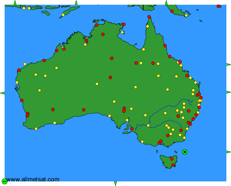
To change the map : click on the green buttons with a black cross to zoom in, on the green button with a dash to zoom out, or on the green arrows for adjacent maps.