METAR-TAF
Airports :
Vienna
Aigen im Ennstal
Altenburg
Altenstadt
Ancona
Ansbach
Augsburg
Aviano
Bad Vöslau
Banja Luka
Bergamo
Bologna
Bolzano
Bratislava
Brescia
Brescia Ghedi
Brno
Budapest
Čáslav
Cerklje ob Krki
Cervia
Dornbirn
Dresden
Erfurt
Ferrara
Florence
Forlì
Friedrichshafen
Frontone
Grafenwöhr
Graz
Győr
Hévíz
Hof
Hohenfels
Illesheim
Ingolstadt
Innsbruck
Karlovy Vary
Kassel
Katowice
Klagenfurt
Laupheim
Lechfeld
Linz
Ljubljana
Maribor
Memmingen
Monte Cimone
Munich
Náměšť nad Oslavou
Neuburg
Niederstetten
Nuremberg
Oberpfaffenhofen
Osijek
Ostrava
Padua
Paganella
Pápa
Pardubice
Parma
Passo della Cisa
Passo Rolle
Pécs
Piacenza
Piešťany
Pisa
Plzeň
Portorož
Prague
Prague
Prague
Pula
Resia Pass
Rijeka
Rimini
Salzburg
Sarajevo
Sarzana
Schwäbisch Hall
Sliač
Split
St. Gallen
St. Moritz
Tarvisio
Toblach
Treviso
Treviso
Trieste
Trieste / Ronchi dei Legionari
Tulln an der Donau
Tuzla
Udine
Uherské Hradiště
Venice
Verona
Vienna
Wiener Neustadt
Wrocław
Zadar
Zagreb
Zell am See
Zeltweg
Žilina
Austria, Czech Republic, Slovenia
Albania
Bosnia and Herzegovina
Croatia
Europe
France
Germany
Hungary
Italy
Italy, North
Macedonia
Montenegro
Poland
Serbia
Slovakia
Slovenia
Switzerland
Vienna International Airport Vienna, Austria
latitude: 48-07N, longitude: 016-34E, elevation: 183 m
Current weather observation The report was made 14 minutes ago, at 13:20 UTC
Wind 9 kt from the South , varying between Southeast and South/Southwest
Temperature 26 °C
Humidity 51 %
Pressure 1017 hPa
Visibility 10 km or more
no clouds below 1500 m and no cumulonimbus
METAR: LOWW 151320Z 17009KT 130V200 CAVOK 26/15 Q1017 NOSIG
Time: 15:34 (13:34 UTC) Forecast The report was made 2 hours and 19 minutes ago, at 11:15 UTC
Forecast valid from 15 at 12 UTC to 16 at 18 UTC
Wind 8 kt from the South/Southeast
Visibility 10 km or more
no clouds below 1500 m and no cumulonimbus
Becoming from 15 at 21 UTC to 15 at 23 UTC
Wind 5 kt from variable directions
Temporary from 15 at 22 UTC to 16 at 02 UTC
Wind 10 kt from the Northwest
Few clouds at a height of 4000 ft, Cumulonimbus. Broken clouds at a height of 5000 ft
rain showers
Probability 30% :
Temporary from 15 at 23 UTC to 16 at 02 UTC
Wind 15 kt from the West with gusts up to 25 kt
Visibility: 3000 m
thunderstorm, rain
From 16 at 0200 UTC
Wind 11 kt from the West/Northwest
Visibility 10 km or more
Broken clouds at a height of 5000 ft
light rain
Temporary from 16 at 02 UTC to 16 at 09 UTC
Wind 15 kt from the West/Northwest with gusts up to 25 kt
rain showers
Becoming from 16 at 11 UTC to 16 at 13 UTC
TAF: LOWW 151115Z 1512/1618 16008KT CAVOK TX25/1515Z TN16/1604Z BECMG 1521/1523 VRB05KT TEMPO 1522/1602 32010KT SHRA FEW040CB BKN050 PROB30 TEMPO 1523/1602 28015G25KT 3000 TSRA FM160200 29011KT 9999 -RA BKN050 TEMPO 1602/1609 29015G25KT SHRA BECMG 1611/1613 NSW
Weather observations and forecasts of more than 4000 airports (METAR and TAF reports).
The available stations are represented by yellow and red dots on the map.
Hover mouse over dot to see the name of the station.
Then click to see weather observations and forecasts.
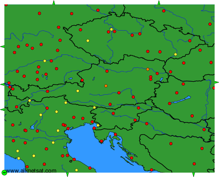
To change the map : click on the green buttons with a black cross to zoom in, on the green button with a dash to zoom out, or on the green arrows for adjacent maps.