METAR-TAF
Airports :
Yamoussoukro Airport
Yamoussoukro, Ivory coast
latitude: 06-54N, longitude: 005-21W, elevation: 196 m
Current weather observation
METAR: DIYO 162100Z 18004KT 9999 SCT011 27/23 Q1011 RETS NOSIG
Time: 21:20 (21:20 UTC)
Forecast
Few clouds at a height of 2000 ft, Cumulonimbus.
Broken clouds at a height of 3000 ft
from 16 at 19 UTC to 16 at 20 UTC
from 17 at 05 UTC to 17 at 08 UTC
from 17 at 08 UTC to 17 at 12 UTC
from 17 at 15 UTC to 17 at 18 UTC
Few clouds at a height of 2000 ft, Cumulonimbus.
TAF: DIYO 161711Z 1618/1718 20008KT 6000 TSRA BKN013 FEW020CB BKN030 BECMG 1619/1620 NSW FEW012 PROB40 1705/1708 4000 BR BKN010 PROB40 1708/1712 BKN012 PROB40 TEMPO 1715/1718 TS BKN013 FEW020CB
Weather observations and forecasts of more than 4000 airports (METAR and TAF reports).
The available stations are represented by yellow and red dots on the map.
Hover mouse over dot to see the name of the station.
Then click to see weather observations and forecasts.
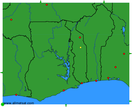
To change the map : click on the green buttons with a black cross to zoom in, on the green button with a dash to zoom out, or on the green arrows for adjacent maps.