METAR-TAF
Airports :
Ilorin International Airport
Ilorin, Nigeria
latitude: 08-29N, longitude: 004-35E, elevation: 308 m
METAR: missing
Time: 12:11 (11:11 UTC)
Forecast
The report was made 6 hours and 11 minutes ago, at 05:00 UTC
Forecast valid from 12 at 06 UTC to 13 at 12 UTC
Wind 2 kt from variable directions
Visibility 10 km or more
Broken clouds at a height of 900 ft
Becoming
from 12 at 08 UTC to 12 at 11 UTC
from 12 at 08 UTC to 12 at 11 UTC
Wind 10 kt from the South/Southwest
Broken clouds at a height of 1200 ft
Temporary
from 12 at 17 UTC to 12 at 23 UTC
from 12 at 17 UTC to 12 at 23 UTC
Scattered clouds at a height of 1300 ft
Few clouds at a height of 2000 ft, Cumulonimbus.
Few clouds at a height of 2000 ft, Cumulonimbus.
thunderstorm
Probability 30%
from 12 at 18 UTC to 12 at 22 UTC
from 12 at 18 UTC to 12 at 22 UTC
Wind 16 kt from the East
Broken clouds at a height of 800 ft
Few clouds at a height of 1800 ft, Cumulonimbus.
Few clouds at a height of 1800 ft, Cumulonimbus.
Becoming
from 12 at 23 UTC to 13 at 01 UTC
from 12 at 23 UTC to 13 at 01 UTC
Wind 2 kt from variable directions
Few clouds at a height of 900 ft
TAF: DNIL 120500Z 1206/1312 VRB02KT 9999 BKN009 BECMG 1208/1211 20010KT BKN012 TEMPO 1217/1223 TS SCT013 FEW020CB PROB30 1218/1222 08016KT 5000-TSRA BKN008 FEW018CB BECMG 1223/1301 VRB02KT FEW009
Weather observations and forecasts of more than 4000 airports (METAR and TAF reports).
The available stations are represented by yellow and red dots on the map.
Hover mouse over dot to see the name of the station.
Then click to see weather observations and forecasts.
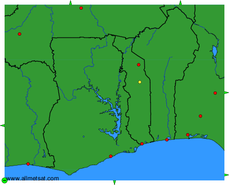
To change the map : click on the green buttons with a black cross to zoom in, on the green button with a dash to zoom out, or on the green arrows for adjacent maps.