METAR-TAF
Airports :
Shemya
Adak Island
Anadyr
Aniak
Anvik
Atka
Bethel
Brevig Mission
Buckland
Cape Lisburne
Cape Newenham
Cape Romanzof
Chevak
Chignik
Clark's Point
Cold Bay
Deering
Dillingham
Elim
Emmonak
False Pass
Gambell
Golovin
Hooper Bay
Kalskag
Kaltag
Kiana
King Cove
Kivalina
Kotzebue
Koyuk
Kwethluk
Manokotak
Marshall
Mekoryuk
Mountain Village
Napakiak
Nelson Lagoon
Noatak
Nome
Noorvik
Platinum
Point Hope
Point Lay
Port Heiden
Quinhagak
Red Dog Mine
Russian Mission
Saint Paul Island
Sand Point
Savoonga
Scammon Bay
Selawik
Shageluk
Shemya
Shishmaref
St. George
St Mary's
St. Michael
Teller
Tin City
Togiak Village
Unalakleet
Unalaska
Wainwright
Wales
White Mountain
Bering Sea
Alaska
Arctic Ocean
Eastern Siberia
North Pacific
Eareckson Air Station Shemya, Alaska, United States
latitude: 52-43-00N, longitude: 174-07-00E, elevation: 95 ft
Current weather observation The report was made 45 minutes ago, at 18:59 UTC
Wind 22 mph from the South/Southeast
Temperature 43 °F
Humidity 93 %
Pressure 30.25 in. Hg
Visibility: 10 miles
Broken clouds at a height of 4600 ft Overcast at a height of 6000 ft
METAR: PASY 181859Z 15019KT 10SM BKN046 OVC060 06/05 A3025 RMK AO2A SLP247 T00550046 PNO FZRANO $
Time: 10:44 (19:44 UTC) Forecast The report was made 5 hours and 44 minutes ago, at 14:00 UTC
Forecast valid from 18 at 14 UTC to 19 at 20 UTC
Wind 17 mph from the South with gusts up to 29 mph
Visibility 6.2 miles or more
Overcast at a height of 500 ft
Becoming
Wind 17 mph from the South/Southeast with gusts up to 29 mph
Visibility 6.2 miles or more
Overcast at a height of 500 ft
Becoming
Wind 29 mph from the Southeast with gusts up to 40 mph
Visibility 6.2 miles or more
Overcast at a height of 500 ft
Becoming
Wind 35 mph from the South with gusts up to 46 mph
Visibility: 5964 ft
Overcast at a height of 200 ft
light rain
TAF: PASY 181400Z 1814/1920 18015G25KT 9999 OVC005 620409 520005 QNH3026INS BECMG 1816/1817 16015G25KT 9999 OVC005 620409 520005 QNH3013INS BECMG 1902/1903 14025G35KT 9999 OVC005 620409 520005 QNH3004INS BECMG 1914/1915 17030G40KT 9000 -RA OVC002 620409 520005 QNH3002INS TX06/1814Z TN05/1902Z LIMITED METWATCH 1814 TIL 1818
Weather observations and forecasts of more than 4000 airports (METAR and TAF reports).
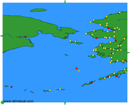
The available stations are represented by yellow and red dots on the map.
Hover mouse over dot to see the name of the station.
Then click to see weather observations and forecasts.
To change the map : click on the green buttons with a black cross to zoom in, on the green button with a dash to zoom out, or on the green arrows for adjacent maps.
