METAR-TAF
Airports :
Bacacheri Airport
Curitiba, Paraná, Brazil
latitude: 25-26S, longitude: 049-16W, elevation: 924 m
Current weather observation
The report was made 1 hour and 9 minutes ago, at 17:00 UTC
Wind 7 kt from the East/Northeast, varying between North and East
Temperature 20°C
Humidity 68%
Pressure 1025 hPa
Visibility 10 km or more
Few clouds at a height of 2500 ft
METAR: SBBI 311700Z 06007KT 010V090 9999 FEW025 20/14 Q1025
Time: 15:09 (18:09 UTC)
Forecast
The report was made 9 hours and 9 minutes ago, at 09:00 UTC
Forecast valid from 31 at 12 UTC to 31 at 24 UTC
Wind 7 kt from the East
Visibility 10 km or more
Few clouds at a height of 4000 ft
Becoming
from 31 at 20 UTC to 31 at 22 UTC
from 31 at 20 UTC to 31 at 22 UTC
Wind 6 kt from the East
Visibility: 8000 m
Scattered clouds at a height of 1000 ft
Becoming
from 31 at 22 UTC to 31 at 24 UTC
from 31 at 22 UTC to 31 at 24 UTC
Visibility: 6000 m
Broken clouds at a height of 800 ft
TAF: SBBI 310900Z 3112/3124 09007KT 9999 FEW040 TX21/3116Z TN12/3123Z BECMG 3120/3122 09006KT 8000 SCT010 BECMG 3122/3124 6000 BKN008 RMK PAB
Weather observations and forecasts of more than 4000 airports (METAR and TAF reports).
The available stations are represented by yellow and red dots on the map.
Hover mouse over dot to see the name of the station.
Then click to see weather observations and forecasts.
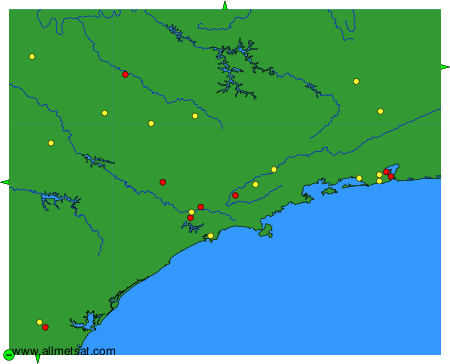
To change the map : click on the green buttons with a black cross to zoom in, on the green button with a dash to zoom out, or on the green arrows for adjacent maps.