METAR-TAF
Airports :
São José dos Campos
Almeirim
Alta Floresta
Altamira
Anápolis
Antofagasta
Aracaju
Araçatuba
Araraquara
Araxá
Asunción
Bagé
Barbacena
Barra do Garças
Bauru
Belém
Belo Horizonte
Belo Horizonte
Belo Horizonte
Boa Vista
Bogotá
Bom Jesus da Lapa
Brasília
Cabo Frio
Cachimbo
Campina Grande
Campinas
Campo Grande
Campos dos Goytacazes
Carolina
Cascavel
Caxias do Sul
Cayenne
Chapecó
Conceição do Araguaia
Córdoba
Corumbá
Criciúma
Cruzeiro do Sul
Cuiabá
Curitiba
Curitiba
Fernando de Noronha
Florianópolis
Fortaleza
Foz do Iguaçu
Goiânia
Guaratinguetá
Guarulhos
Ilhéus
Imperatriz
Ipatinga
Itaituba
Jacareacanga
João Pessoa
Joinville
Juazeiro do Norte
Juiz de Fora
Lábrea
La Paz
Lençóis
Lima
Londrina
Macaé
Macapá
Maceió
Manaus
Manaus
Manicoré
Marabá
Marília
Maringá
Mendoza
Montes Claros
Mossoró
Natal
Natal
Navegantes
Oiapoque
Palmas
Parauapebas
Parnaíba
Passo Fundo
Paulo Afonso
Pelotas
Petrolina
Pirassununga
Poços de Caldas
Ponta Porã
Porto Alegre
Porto Alegre
Porto Seguro
Porto Velho
Presidente Prudente
Quito
Recife
Ribeirão Preto
Rio Branco
Rio de Janeiro
Rio de Janeiro
Rio de Janeiro
Rio de Janeiro-Galeão
Salvador
Santa Cruz
Santa Maria
Santarém
Santiago
Santos
São Gabriel da Cachoeira
São José do Rio Preto
São José dos Campos
São Luís
São Paulo
São Paulo
São Pedro da Aldeia
Tabatinga
Tarauacá
Taubaté
Tefé
Teresina
Tucuruí
Uberaba
Uberlândia
Uruguaiana
Vilhena
Vitória
Vitória da Conquista
Brazil
Argentina
Bolivia
Brazil, São Paulo, Rio de Janeiro
Chile
Colombia
Ecuador
Guyana, Suriname, French Guiana
Paraguay
Peru
South America
South Atlantic
South Pacific
Uruguay
Venezuela
São José dos Campos Airport São José dos Campos, São Paulo, Brazil
latitude: 23-14S, longitude: 045-52W, elevation: 646 m
Current weather observation The report was made 31 minutes ago, at 14:00 UTC
Wind 9 kt from the West , varying between South/Southwest and West
Temperature 26 °C
Humidity 70 %
Pressure 1017 hPa
Visibility 10 km or more
Few clouds at a height of 2300 ft Broken clouds at a height of 3000 ft Few clouds at a height of 4500 ft, Towering cumulus.
METAR: SBSJ 091400Z 26009KT 210V280 9999 FEW023 BKN030 FEW045TCU 26/20 Q1017
Time: 11:31 (14:31 UTC) Forecast The report was made 6 hours and 1 minutes ago, at 08:30 UTC
Forecast valid from 09 at 12 UTC to 09 at 24 UTC
Wind 5 kt from the West
Visibility: 7000 m
Broken clouds at a height of 1600 ft
Becoming
Wind 7 kt from the West/Southwest
Visibility 10 km or more
Broken clouds at a height of 2000 ft
Becoming
Wind 7 kt from the South
Visibility: 8000 m
Broken clouds at a height of 1600 ft
TAF: SBSJ 090830Z 0912/0924 26005KT 7000 BKN016 TX28/0916Z TN19/0923Z BECMG 0914/0916 24007KT 9999 BKN020 BECMG 0917/0919 19007KT 8000 BKN016 RMK PGM
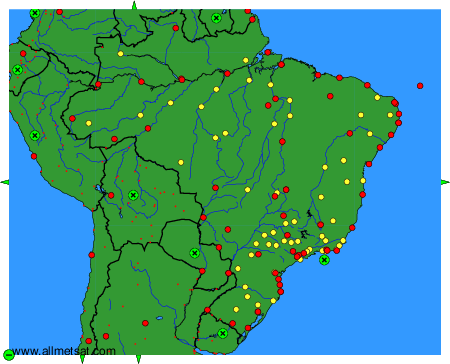
Weather observations and forecasts of more than 4000 airports (METAR and TAF reports).
The available stations are represented by yellow and red dots on the map.
Hover mouse over dot to see the name of the station.
Then click to see weather observations and forecasts.
To change the map : click on the green buttons with a black cross to zoom in, on the green button with a dash to zoom out, or on the green arrows for adjacent maps.
