METAR-TAF
Airports :
Port Hardy
Abbotsford
Agassiz
Arlington
Ballenas Island
Bella Bella
Bella Coola
Bellingham
Blue River
Burlington / Mount Vernon
Burns Lake
Campbell River
Castlegar
Cathedral Point
Chetwynd
Clinton
Comox
Creston
Dawson Creek
Dease Lake
Eastsound
Edson
Entrance Island
Esquimalt Harbour
Estevan Point
Fort Nelson
Fort St. John
Friday Harbor
Golden
Grande Prairie
Grey Islet
Herbert Island
High Level
Holland Rock
Hope
Ingenika Point
Jasper
Kamloops
Kelowna
Kelp Reefs
Lucy Island
Lytton
Mackenzie
Malahat
Nakusp
Nanaimo
Nelson
Oak Harbor
Omak
Osoyoos
Peace River
Penticton
Pitt Meadows
Port Angeles
Port Angeles
Port Hardy
Port Townsend
Powell River
Prince George
Prince Rupert
Princeton
Princeton
Quesnel
Race Rocks
Revelstoke
Salmon Arm
Sand Heads CS
Sandpoint
Saturna Island
Sheringham
Sisters Islands
Smithers
Solander Islands
Spirit River
Squamish
Stewart
Summerland
Terrace
Tofino
University of Victoria
Vancouver
Vernon
Victoria
Victoria
Victoria Harbour
West Vancouver
Whistler
White Rock
Williams Lake
Yoho National Park
British Columbia
Alaska, British Columbia
Alberta
Idaho
Montana, West
North America
Northwest Territories
Washington
Yukon
Port Hardy Airport Port Hardy, British Columbia, Canada
latitude: 50-41N, longitude: 127-22W, elevation: 22 m
Current weather observation The report was made 34 minutes ago, at 13:00 UTC
Wind 4 kt from the West , varying between West and North/Northwest
Temperature 11 °C
Humidity 82 %
Pressure 1019 hPa
Visibility: 16.1 km
Broken clouds at a height of 1500 ft
METAR: CYZT 101300Z 28004KT 260V340 10SM BKN015 11/08 A3009 RMK SC7 SLP192
Time: 06:34 (13:34 UTC) Forecast The report was made 54 minutes ago, at 12:40 UTC
Forecast valid from 10 at 13 UTC to 11 at 01 UTC
Wind 8 kt from the West
Visibility: 10 km
Scattered clouds at a height of 1500 ft
Temporary from 10 at 13 UTC to 10 at 18 UTC
Broken clouds at a height of 1200 ft
Becoming from 10 at 16 UTC to 10 at 18 UTC
Wind 12 kt from the North/Northwest with gusts up to 22 kt
From 10 at 2300 UTC
Wind 15 kt from the Northwest with gusts up to 25 kt
Visibility: 10 km
Scattered clouds at a height of 1500 ft
TAF: CYZT 101240Z 1013/1101 26008KT P6SM SCT015 TEMPO 1013/1018 BKN012 BECMG 1016/1018 33012G22KT FM102300 32015G25KT P6SM SCT015 RMK NXT FCST BY 101900Z
Weather observations and forecasts of more than 4000 airports (METAR and TAF reports).
The available stations are represented by yellow and red dots on the map.
Hover mouse over dot to see the name of the station.
Then click to see weather observations and forecasts.
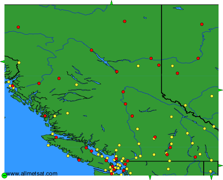
To change the map : click on the green buttons with a black cross to zoom in, on the green button with a dash to zoom out, or on the green arrows for adjacent maps.